Hydrology Analyst
Hydrological analysis is based on a digital elevation model (DEM) raster data to establish a water system model, which is used to study the hydrological characteristics and simulation of surface hydrological process, and make a forecast for the surface hydrological situation in the future. The hydrological analysis model can help us to analyze the scope of the flood, position the runoff pollution sources, and predict geomorphological change on runoff. It is widely used in regional planning, agriculture, forestry, disaster prediction, road design, and many other industries and fields.
The confluence of the surface water is largely determined by the surface shape. DEM data is able to express the spatial distribution of the regional topography. It has outstanding advantages in the description of watershed topography, such as watershed boundaries, slope, and aspect, extracting drainage, thus very suitable for hydrological analysis.
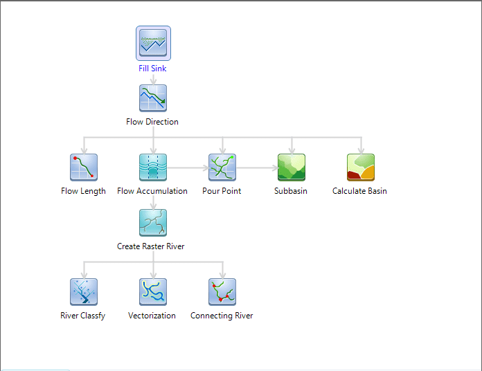
SuperMap hydrological analysis contains filling sinks, calculating flow direction, calculating length, calculating cumulative water, watershed divided, river grading, connecting water system and vectorization.
Figure: Workflow of Hydrology Analysis
Main Contents:
Overview of Hydrology Analysis
Introduction to Workflow Manager of Hydrology Analysis
Related Topics
The workflow management helps you manage and customize all modules automatically. The hydrology analysis module uses this management.
