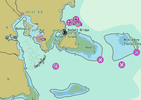
The electronic nautical chart is a major technological breakthrough in
maritime field, which is of great significance for navigation safety. With the
development of navigation, adds a nautical chart module. SuperMap supports
S-57 and S-52, the import and export of the *.000 format, chart creation,
color modes, feature display, basic operations, etc. On this basis, SuperMap
focuses on the integration of chart data and land data.
Integration storage of land and sea.
The chart module of SuperMap realizes to store chat data (*.000) in the way of dataset group, and both chart dataset other GIS datasets can be managed and operated together. This approach facilitates to maintain both of the land and sea data, reducing the cost of maintenances.
Integration displaying of land and sea.
- Integration displaying for multiple charts
Multiple charts with the same extent can be added to one map window, so that those charts can be appended seamlessly. The following figure shows the effect of three charts overlapped.
- Integration displaying of land and sea.
The nautical chart module of SuperMap enables to display the chart and land map in an seamless way, rather than separately display a chart and a land map.
Integrated publishing of land and sea.
The nautical chart module of SuperMap can create the map cache, and it can be published on the server side.
The achievement of the integration of storage, display and publishing of the land and sea in the nautical chart module breaks the limitations of charts, meets the strong demand of chart and land map fusion, and provides perfect solutions for the maritime transportation, maritime and land emergency rescue, marine resources and inland waterway resources development, etc.
