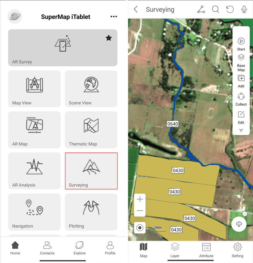
The Surveying module allows you to collect data in field based on a collection template.
On the Home page click Surveying to access the functional module.
Collect data
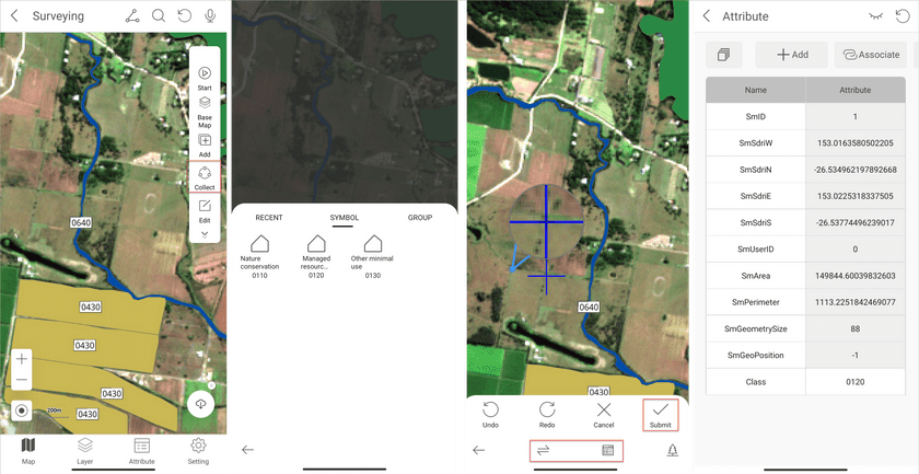
- Click Collect on the right toolbar, select the symbol you want to draw, and then draw objects on your map. You can add objects by clicking on the screen. Or click the second button on the bottom toolbar to switch the collection way. The supportive collections include Collect Points by GPS, Collect Line by GPS, Point Draw, and Free Draw.
- Click Submit to finalize the drawing of object.
- Click the third button on the bottom toolbar to add attributes of the currently drawing object.
Edit data
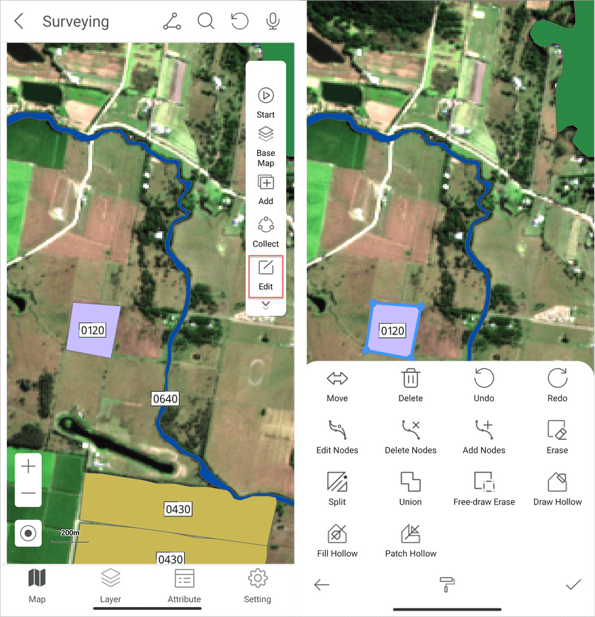
- On the Surveying page click the Edit button. Select the object that you want to edit. In the popup choose the operation you want to perform. You can undo the last modification and redo the last undone action. (Note: once an object is deleted, you can’t recover it.)


