You can generate vector tiles through two ways: a single task, multiple tasks. Here we adopt the second way.
Basic steps
- Open the workspace “China.smwu” in iDesktop, and set it read-only.
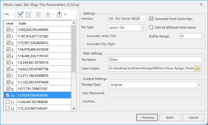
- Open the map “China”, and then right click your mouse on the map window and select “Map Tile(Multi-task)…”, and in the pop-up dialog box, select “Create and Run New Tasks” to head to the “Multi-task: Set Map Tile Parameters (China)” dialog box.
- Set Tile Type to Vector Tile.
- Set scale levels, here the scales level we set is from 1 to 10.
- The final result consists of vector tile data, tile styles, and tile font files which are saved in different folders.
- Path Settings : Set a name for the tiled map and a path to save the result.
- Set Storage Type to Origin. For more details on storage types, please refer to Map tile types.
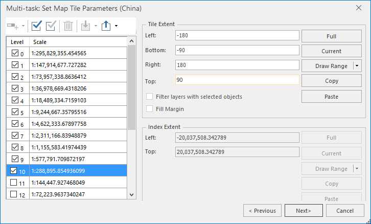
- Tile Bounds : Click “Next” to head to the “Tile Bounds” page to specify a tile bounds.
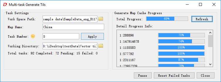
- Click “Next” to open the “Multi-task Generate Tiles” dialog box, and then specify the number of processes in the “Task Number” text box, for more details, please refer to Run Map Tile(Multi-task).
- Click “OK” to begin generating tiles. And you can click Refresh to view the progress.
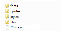
- After completing generating all tiles, folders and files as following picture shows are produced in the output path.

- fonts : Files about fonts used by vector tiles.
- sprites : Resources relevant to icons’ styles.
- styles : Style description files.
- tiles : vector tile data. If the storage type is original, the tile format is *.mvt. But if the storage type is compact, the tile format is *.cf.
Vector tile data is saved in different folders according to relative scale levels. Names of folders under the folder “tiles” correspond to the levels of globe subdivision. The first level is 0. Names of folders under the level folders are column number of globe subdivision, and vector tiles whose names are row number of globe subdivision are saved under these folders.
- sci : A meta information description file recording the data projection, geographic range, scales, and so on.
Related topics :


