While configuring maps, we often need to represent point, line, polygon dataset information together. To optimize map display, we can achieve this through adjusting the layer order, setting anti-aliasing effect, setting minimum display size for objects, setting display of complete line, etc.
Basic Steps
- In the Workspace Manger, select multiple datasets, right click, select Add to New Map to open the selected data in the same map.
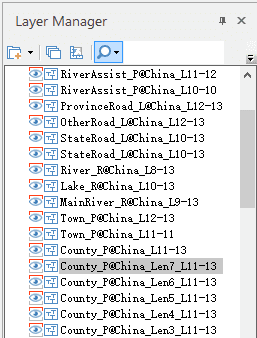
- In Layer Manager, adjust the layer order through dragging.
- In the Properties group on the Map tab, click Map Properties button to display Map Properties panel, check Line Antialiasing and Text Antialiasing to eliminate the zigzags of the text and vector datasets.
- In the Properties group on the Map tab, click Layer Properties button to display the Layer Properties panel. Select all region and line datasets in Layer Manager, set Min Object Size in the Layer Properties panel to 0 to avoid the situations of incomplete objects.
- Meanwhile, in the Layer Properties panel, check Complete Line box to have better display effects line layers with large number of short lines and polylines.
