


Hydrology
Hydrology establishes water system models based on Digital Elevation Models (DEM) to study watershed hydrological characteristics, simulate surface hydrological processes, and estimate future surface hydrological conditions. It helps analyze flood extents, locate surface runoff pollution sources, predict the impact of terrain changes on runoff, and is widely applied in regional planning, agriculture/forestry, disaster prediction, road design, and other fields.
Surface water convergence largely depends on terrain morphology. DEM effectively represents regional landforms and demonstrates outstanding advantages in describing watershed topography, slope and aspect analysis, and river network extraction, making it particularly suitable for hydrological analysis.
SuperMap's hydrological tools mainly include fill sinks, flow direction, flow length, calculate cumulative flow accumulation, stream order, stream link, and stream to feature processes.
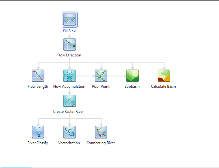 |
| Figure: Hydrology analysis process |
This section includes the following:
- Hydrology Overview
- Fill Sinks
- Flow Direction
- Calculate Cumulative Flow Accumulation
- Flow Length
- Calculate Watershed Basin
- Watershed
- Stream System
- Stream Order
- Stream Link
- Stream to Feature