


Stream Link
Feature Description
Stream Link is the process of assigning unique values to each river in a water system based on raster river system and direction raster.
The connected river network records the connection info of river nodes and reflects the network structure. After connection succeeded, each river segment has a unique raster value. As shown in the figure below, red points represent junctions where river segments intersect. A river segment is part of a river that connects two adjacent junctions, a junction and a catchment point, or a junction and a watershed.
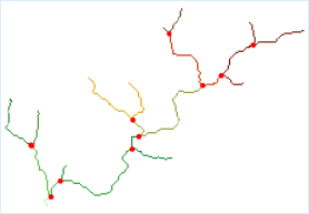 |
| Figure: Stream Link Diagram |
In the final stream link result, the linear raster network of rivers should have values greater than or equal to 1, as shown below.
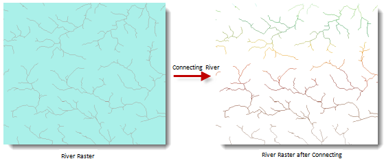 |
| Figure: Stream Link Result Diagram |
Feature Entry
- Spatial Analysis Tab - >Raster Analysis Group -> Hydrology -> Stream Link.
- Toolbox -> Raster Analysis -> Hydrology -> Stream Link.
Parameter Description
- River System Data: Select the datasource and dataset where the raster river system is located.
- Flow Direction Data: Select the datasource and dataset containing flow direction data. For generating flow direction data, see Flow Direction.
- Result Data: Set the datasource name and dataset name for saving results.
- Click the Execute button to run the analysis. After the execution is completed, the output window will indicate whether the result was successful or failed.