


Hydrological Analysis
Hydrological Analysis is based on the Elevation Model (DEM) to establish the water system model, which is used to study the hydrological characteristics of the basin, simulate the surface hydrological process, and estimate the future surface hydrological conditions. Hydrological Analysis can help us analyze the scope of the flood, locate the source of surface runoff pollution, and predict the impact of landform changes on runoff. It is widely used in regional planning, agriculture and forestry, disaster prediction, Road Design and other industries and fields.
The confluence of surface water depends largely on the shape of the earth's surface, and DEMs can well express the geomorphology of a region, which has outstanding advantages in describing the basin terrain, Slope and Aspect Analysis, river network extraction and other aspects, and is very suitable for Hydrology Analysis.
Hydrological Analysis of SuperMap mainly includes Fill Sinks, Calculate Flow Direction, Calculate Flow Length, Several procedures such as Cumulative Flow Accumulation, Stream Order, Connect River System, and River System Vectorization are calculated.
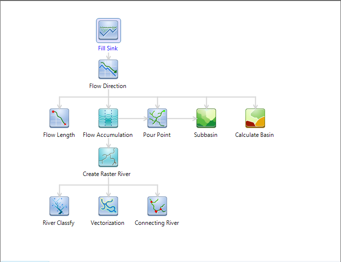 |
| Figure: Hydrology Analysis Process Diagram |
Executive summary:
 Hydrological Analysis Overview
Calculate Cumulative Flow Accumulation.