


S-101, fully known as the IHO Electronic Navigational Chart Product Specification, also referred to as S-101 ENC, is the latest product specification for Electronic Navigational Charts (ENCs).
- Relationship with S-100 Standard: As the most fundamental specification within the S-100 product specification system, S-101 provides the base map for Electronic Navigational Charts. Other interoperable products in the S-100 series can be overlaid on S-101 base data, such as S-102 Bathymetric Surface and S-104 Water Level Information for Navigation.
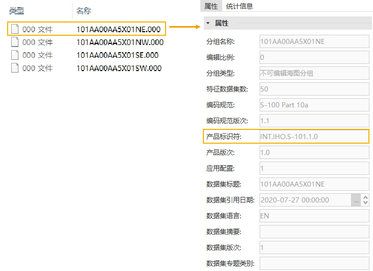
- Data Content and Format: S-101 specifies the compilation content, structure, data encoding, and metadata for Electronic Navigational Chart data. The data storage format is the *.000 file, which corresponds to the chart group in SuperMap iDesktopX. A chart group contains feature datasets for the chart. As shown in the figure below, *.000 data compliant with the S-101 specification typically includes information such as name, number of feature datasets, encoding specification, dataset reference date, and product identifier.
 |
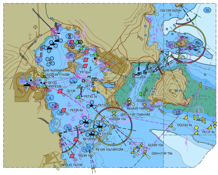 |
| 000 File and Attributes Compliant with S-101 Specification | S-101 Electronic Navigational Chart Illustration |
The S-100 series is often regarded as an update to the S-57 series standards (see S-100 Overview for details). Comparing the two series of specifications, S-101, which also serves as an Electronic Navigational Chart data specification and is stored in the *.000 format, is the successor to S-57 (Transfer Standard for Digital Hydrographic Data).
SuperMap iDesktopX supports opening, displaying, and querying attributes of S-101 data. By default, visibility control for the entire chart is based on the maximum and minimum display scales of the DataCoverage feature in the S-101 chart data group. In this section, you will learn about the following:
- View S-101 Data: Describes how to import *.000 files that comply with the S-101 Electronic Navigational Chart data standard.
- Export S-101 Data: Describes how to export S-101 Electronic Navigational Chart data to *.000 or *.shp files.
- S-101 Data Display: Explains how to display chart data by setting Vertex Color and Bathymetric Mode. It also supports setting the Chart Display Type.
- Create Feature Datasets: Describes how to create feature datasets for S-101 Electronic Navigational Chart data.
- View Feature Object Properties: Describes how to view the attributes, reference objects, and nodes of S-101 feature objects.
- Modify Feature Object Properties: Describes how to modify the attributes, related information, and connective tissue of S-101 feature objects.