


S-102 Bathymetric Surface
S-102, officially named Bathymetric Surface Product Specification (abbreviated as S-102 Bathymetric Surface), aims to standardize the representation of high-resolution seabed terrain data.
S-102 provides a standardized format for storing and transmitting seabed elevation data, supporting applications such as marine navigation, environmental monitoring, and marine engineering. These data are presented in a regular grid structure, enabling precise depiction of seabed topography for safer and more accurate navigation.
- Storage format:S-102 data is typically stored in grid format (*.h5) as full-coverage data (Coverage Data), containing bathymetric values. This format organizes seabed elevation data into a regular 2D grid where each cell contains depth values. The data files follow specific encoding structures to ensure compatibility with other marine data standards.
- Data content:S-102 data represents a high-resolution digital model of seabed topography. Its display effects resemble terrain maps, where depth variations are visualized through color gradients or contour lines.
- Relationship with S-100 standard:S-102 primarily provides detailed bathymetric data to enhance navigation accuracy in Electronic Chart Display and Information Systems (ECDIS). As a key component under the S-100 framework, it works in conjunction with other standards (e.g., S-101 electronic chart) to improve the overall functionality and precision of navigation systems.
- Relationship with S-101: S-101 is a chart data standard focusing on maritime navigation information, including bathymetric data typically represented as point data for basic navigation safety. In contrast, S-102 offers more detailed seabed elevation data with enhanced spatial accuracy, serving as a vital complement to S-101 data by providing comprehensive seabed terrain details.
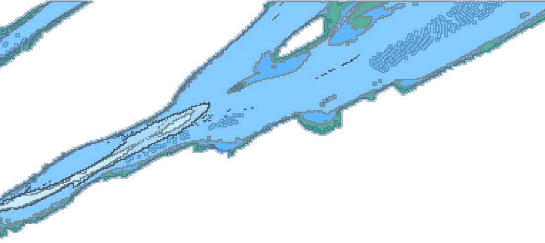 |
| S-102 Bathymetric Surface Illustration |
SuperMap iDesktopX supports importing and displaying S-102 bathymetric surface data. In this section, you will learn about:
- Open S-102 data: Explains how to import *.h5 files compliant with the S-102 specification.
- S-102 data display: Describes how to visualize chart data through bathymetric mode settings, including configurations for shallow/deep water thresholds and safety contours.
- Depth query: Explains how to query depth values from S-102 bathymetric surfaces.