Instructions
divides all coordiante systems into three classes: planar coordinate systems, geographic coordinate systems, and projected coordinate systems. You are allowed to set different types of coordinate systems for datasources or datasets according to needs.
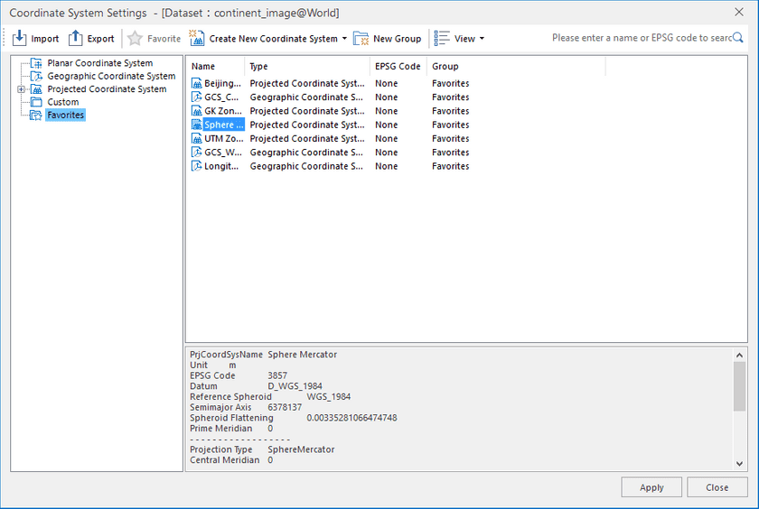
The Projection Set command in the Data Processing group which is in the Start tab allows you to set the projection for the datasource or dataset in the workspace.
The Set command is only active if there are selected datasources or datasets in the workspace. The Set buttonDropDown appears in two parts: the image part and the text part with a drop-down arrow. You can click the image part to directly open the Projection Settings window, or click the drop-down arrow to select a projection from My Favorites list. For more information on My Favorites list for projections, please refer to the introduction to the Projection Settings - Favorites in the Function Area in the Projection Settings window. The drop-down list will be empty if there are no projections added to Favorites.
Basic Steps
In the Workspace Manager, select the datasource or dataset for which you want to transform the projection, click Set in the Projection group to display the Projection Settings window. If you have selected several datasources or datasets, the Projection Settings window pops up for the projection setting of the last selected datasource or dataset. The Projection Settings window may vary depending on the coordinate system type of the last selected datasource or dataset. Your last selected datasource or dataset may be in:
Note
You can locate the search box through the shortcut key Ctrl+F/Ctrl+F3.
Setting Planar Coordinate System
