


Raster Splice
Feature Description
Raster splice refers to merging multiple raster or image data files into a single dataset through batch processing. It supports combining both datasets and local files, eliminating the data import process and improving data processing efficiency.
Application Scenarios
Raster data splicing has broad practical applications, such as in drone aerial photography and remote sensing imagery processing. It is particularly suitable for large-volume data splicing, significantly enhancing data processing efficiency.
Feature Entry
Data Tab -> Data Processing -> Merge Button.
Parameter Description
- Add File/Add Dataset: Supports adding both datasets and files via the Add File and Add Dataset toolbar buttons. Requirements:
- Input data must share the same coordinate system;
- Input data must have identical pixel formats;
- For image data inputs, band counts must be consistent.
- New Dataset:
- When checked, creates a new raster/image dataset matching the input data's type. The target dataset inherits the coordinate system, pixel format, and band count from input data. Its bounds cover the union of all input data ranges. Input data is appended to create the final spliced result.
- When unchecked, performs raster update by appending listed data to an existing target dataset.
- Encode Type: Required when creating new dataset. Options include SGL, DCT, LZW, PNG, and compound. Default is no encoding. For details see Dataset Compression Encode Types.
- Data Type: Supported types are Raster and Image. Splicing can only occur within the same data type. The system automatically filters datasets based on selected type. Default is Raster.
- Target Datasource: Specifies the datasource for the output dataset.
- Target Dataset: Defines the name of the output spliced dataset.
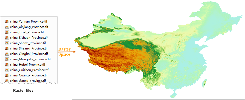
Example:
34 provincial DEM raster files with identical coordinate systems and pixel formats are spliced using this function. The result is shown below:
 |
Related Topics