


Registered videos establish mapping relationships with geospatial coordinates, allowing overlay of GIS vector and raster data such as points, lines, polygons, text, pipelines, terrain, imagery, and aerial landmarks to enhance video display effects and enrich map information.
GIS-Enhanced Video
Add 2D/3D point, line, and polygon vector data to registered videos. Modify vector data styles or create thematic maps according to practical needs to achieve GIS-enhanced video display.
Step 1: Create Video Map Window
There are two methods to create a video map window:
- Click Start Tab -> Browse -> Video Maps.
- Workspace Manager -> Video Maps node context menu -> Create Video Map Window.
There are two ways to open video maps:
- Double-click saved video maps under Workspace Manager -> Video Maps node.
- Double-click video datasets in Workspace Manager to open them in video maps.
Step 2: Add Video and GIS Data
In video maps, you can add video datasets, 2D/3D point/line/region datasets, text datasets, etc. Registered video data can be overlaid with geographic data. Drag datasets directly into opened video maps, or use the Add to New Video Map or Add to Current Video Map options in dataset context menus. Supports layer style configuration, object selection style setup, thematic map creation, layer display order adjustment, and layer removal.
Data in geographic coordinate systems cannot be added to video map windows.
Step 3: Configure Vector Layer Styles
Use the Styles tab to configure vector layer styles. Set point symbols, line styles, polygon fill patterns based on object types, and perform extrusion settings. For details, refer to Layer Style Configuration.
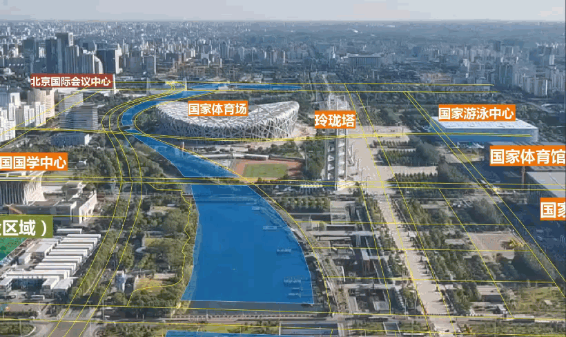
The video with added GIS data and completed styles is shown below:
Video-Enhanced GIS
Integrate videos into maps and overlay them with online/raster base maps to improve map information richness, achieving video-enhanced GIS.
Step 1: Video Registration
Before adding videos to maps for overlay with geographic data, perform video registration. For registration operations, see Video Registration Chapter.
Step 2: Add Video and GIS Data
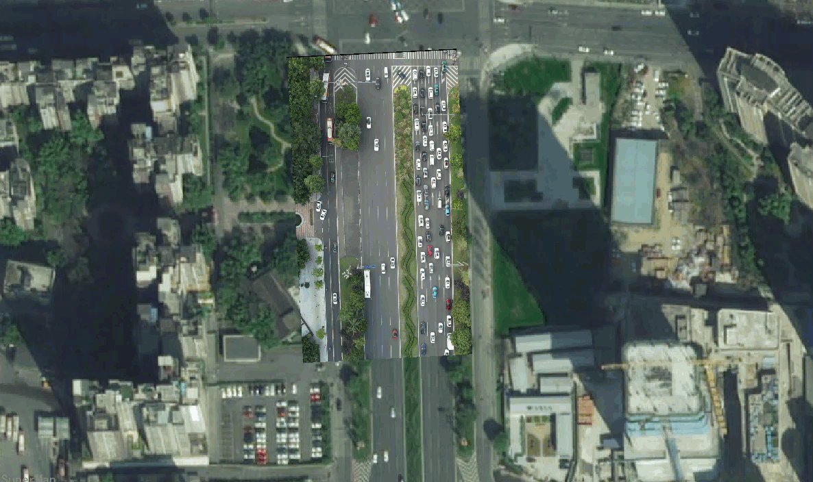
Select video datasets and use context menu options Add to Current Map or Add to New Map. When adding to existing maps, ensure the video data shares the same coordinate system with the map. After successful addition, overlay other vector data as needed. The display effect of video overlaid with online imagery base maps is shown below:
Related Topics