


In SuperMap, data coordinate systems are divided into three categories: planar coordinate system, geographic coordinate system, and projected coordinate system.
Planar Coordinate System
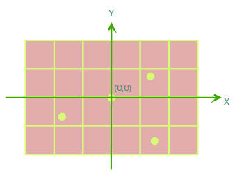
It is generally used as the coordinate reference for data unrelated to geographical locations and is also the default coordinate reference for newly created data, such as CAD design drawings, scanned images of paper maps, schematic diagrams unrelated to geographical locations, etc. A planar coordinate system is a two-dimensional coordinate system with an origin at (0,0), where the coordinates of each point in the data are determined by its distances from the horizontal X-axis and vertical Y-axis.
Geographic Coordinate System
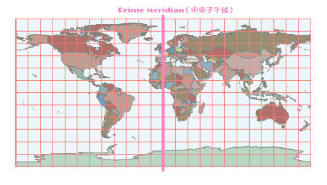
It uses latitude and longitude coordinates to represent any point on the ellipsoid. In a geographic coordinate system, it typically includes definitions for the horizontal datum, prime meridian, and angular units. Commonly used geographic coordinate systems include WGS 1984, Beijing 1954, Clarke 1866, etc. For example, KML data on Google Earth and data collected by the Global Positioning System use WGS 1984 as the coordinate system. Control point coordinates obtained from geodetic surveys use Xi'an 80 or Beijing 1954 as the coordinate system. The figure shows a world map in the WGS 1984 coordinate system.
Projected Coordinate System
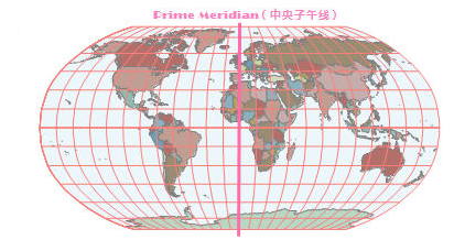
It projects any point on the ellipsoid onto a plane using a certain projection type. It uses two-dimensional planar coordinates (X, Y) to represent the positions of point, line, and area features. A projected coordinate system typically includes definitions for the geographic coordinate system, map projection, parameters, and distance unit. Commonly used projected coordinate systems include Gauss Kruger, Albers, Lambert, Robinson, etc. Generally, projected geographic data can be used for map measurement, various spatial analyses, cartographic representation, etc. For example, in China's basic scale topographic maps, the 1:1,000,000 scale map uses Lambert projection, while most others use Gauss-Kruger 6-degree or 3-degree zone projections. Large-scale maps used in urban planning, such as road construction drawings and architectural design drawings at scales like 1:500 or 1:1000, often use a planar coordinate system. The figure shows the world map originally in the WGS 1984 coordinate system projected using Robinson projection.
Related Topics
Reference System Conversion Methods