com.supermap.data
Class DatasetType
- java.lang.Object
-
- com.supermap.data.DatasetType
-
public class DatasetType
extends java.lang.Object
Defines dataset types.A dataset is a collection of related data stored together. According to the types of data, there are vector dataset, raster dataset, and the dataset designed for specific problems, such as topology dataset, network dataset etc. For different features may have different spatial representations, the vector dataset includes point dataset, line dataset, region dataset and so on, and the features with the same spatial representation and function will be organized together. Raster dataset includes grid dataset and image dataset.
-
-
Field Summary
Fields Modifier and Type Field and Description static DatasetTypeCADCAD dataset is used to store multiple kinds of datasets.static DatasetTypeGRIDThe grid dataset is mostly used to do some analysis based on raster, so the value of a cell represents certain attribute of a geographic feature, such as elevation, rainfall, etc.static DatasetTypeIMAGEThe image dataset belongs to the raster dataset, such as image map, multi-wave image and photo.static DatasetTypeLINEThe line dataset is used to store the line objects, like the distributing of rivers, roads and national boundaries.static DatasetTypeLINE3DLine3D dataset.The Line3D dataset is mainly used to store the 3D line objects.static DatasetTypeNETWORKThe network dataset is used to store the dataset with topological relationship in network, such as the transportation network.static DatasetTypeNETWORK3D3D network dataset.The dataset is mainly used to store the 3D network data, such as the building, pipe and so on.static DatasetTypePOINTThe point dataset is used to store the point objects, such as distributing of the disperse points in this figure.static DatasetTypePOINT3DPoint3D dataset.The Point3D dataset is mainly used to store the 3D point objects.static DatasetTypeREGIONPolygon dataset is used to store region objects, like the distributing of residential areas and administrative area.static DatasetTypeREGION3DRegion3D dataset.The Region3D dataset is mainly used to store the 3D region objects.static DatasetTypeTABULARThe tabular dataset is mainly used to store and manage the pure attribute data that describe the information of the characters and shapes of the surface features, such as the length and width of the river.This dataset does not contain graphics data in it, namely the dataset can not be displayed in the map window as a layer.static DatasetTypeTEXTThe text dataset is used to store the text objects, such as the text of the annotation.static DatasetTypeVECTORCACHEvector cache datasetstatic DatasetTypeVIDEOVIDEO datasetstatic DatasetTypeWCSWCS dataset, which is used in image multispectral mapstatic DatasetTypeWFSWFS dataset.static DatasetTypeWMSWMS dataset, which is used in online real map
-
-
-
Field Detail
-
TABULAR
public static final DatasetType TABULAR
The tabular dataset is mainly used to store and manage the pure attribute data that describe the information of the characters and shapes of the surface features, such as the length and width of the river.This dataset does not contain graphics data in it, namely the dataset can not be displayed in the map window as a layer.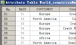
-
POINT
public static final DatasetType POINT
The point dataset is used to store the point objects, such as distributing of the disperse points in this figure.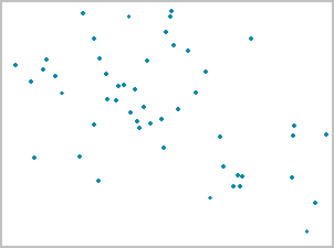
-
LINE
public static final DatasetType LINE
The line dataset is used to store the line objects, like the distributing of rivers, roads and national boundaries.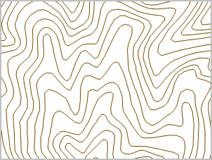
-
REGION
public static final DatasetType REGION
Polygon dataset is used to store region objects, like the distributing of residential areas and administrative area.
-
TEXT
public static final DatasetType TEXT
The text dataset is used to store the text objects, such as the text of the annotation.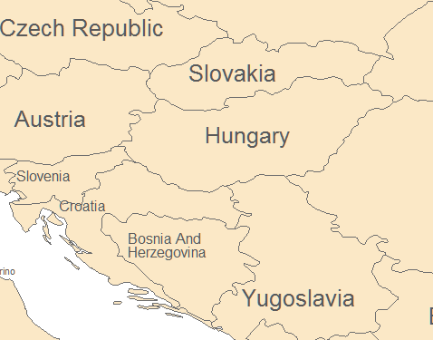
-
IMAGE
public static final DatasetType IMAGE
The image dataset belongs to the raster dataset, such as image map, multi-wave image and photo. The image dataset is used to be displayed or used as the base map, so the value of a cell is the value of a color or the value of an indexed color.
-
CAD
public static final DatasetType CAD
CAD dataset is used to store multiple kinds of datasets.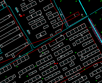
-
NETWORK
public static final DatasetType NETWORK
The network dataset is used to store the dataset with topological relationship in network, such as the transportation network. The network dataset is different with the point dataset and the line dataset. The network dataset contains the line objects, the note objects and the topological relationship between them. The network dataset is used for network analysis such as finding the shortest path, performing a service area analysis, closest facility analysis, location-allocation analysis, bus transfer, adjacent node and connected node analysis.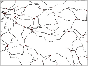
-
NETWORK3D
public static final DatasetType NETWORK3D
3D network dataset.The dataset is mainly used to store the 3D network data, such as the building, pipe and so on.
-
GRID
public static final DatasetType GRID
The grid dataset is mostly used to do some analysis based on raster, so the value of a cell represents certain attribute of a geographic feature, such as elevation, rainfall, etc.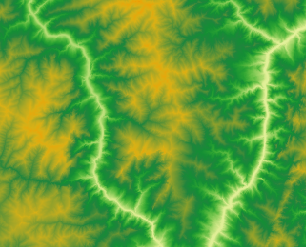
-
POINT3D
public static final DatasetType POINT3D
Point3D dataset.The Point3D dataset is mainly used to store the 3D point objects.
-
LINE3D
public static final DatasetType LINE3D
Line3D dataset.The Line3D dataset is mainly used to store the 3D line objects.
-
REGION3D
public static final DatasetType REGION3D
Region3D dataset.The Region3D dataset is mainly used to store the 3D region objects.
-
WMS
public static final DatasetType WMS
WMS dataset, which is used in online real map- Example:
 To open the WMS Service data by default:

 DatasourceConnectionInfo info = new DatasourceConnectionInfo();
 info.setDriver("WMS");
 info.setEngineType(EngineType.OGC);
 info.setDriver("WMS");

 To open the WMS Service data by default:

 DatasourceConnectionInfo info = new DatasourceConnectionInfo();
 info.setDriver("WMS");
 info.setEngineType(EngineType.OGC);
 info.setDriver("WMS");
 info.setWebVersion("1.3.0");
 info.setWebFormat("image/png");
 info.setWebVisibleLayers("topp:states");
 info.setWebVersion("1.3.3857");
 Rectangle2D rect = new Rectangle2D(-2.003750834278E7, -2.003750834279E7, 2.003750834278E7, 2.003750834279E7);
 info.setWebBBox(rect);
-
WCS
public static final DatasetType WCS
WCS dataset, which is used in image multispectral map- Example:
 DatasourceConnectionInfo info = new DatasourceConnectionInfo();
 info.setEngineType(EngineType.OGC);
 info.setDriver("WCS");
-
WFS
public static final DatasetType WFS
WFS dataset. Vector feature meets the query and statistics requirements.- Example:
 DatasourceConnectionInfo info = new DatasourceConnectionInfo();
 info.setEngineType(EngineType.OGC);
 info.setDriver("WFS");
-
VECTORCACHE
public static final DatasetType VECTORCACHE
vector cache dataset
-
VIDEO
public static final DatasetType VIDEO
VIDEO dataset
-
-


