


Generate Isobaths
Feature Description
Generating nautical chart isobaths (depth contour lines) is a critical step in marine cartography. Isobaths visually represent water depth variations as graphical tools for underwater topography, commonly used in navigation charts, oceanographic research, and marine engineering projects. When generating isobaths, depth measurement data (such as multibeam sonar or LIDAR bathymetric data) typically undergoes interpolation and smoothing processes to produce accurate depth distribution representations.
The Generate Isobaths feature can create water area isobath data based on depth point datasets and water area boundaries.
Steps
- Import the point dataset for generating water area isobaths.
- Chart Tab -> Chart Data Processing group -> Generate Isobaths button to open the Generate Isobaths dialog.
- Configure source data and parameters:
- Parameters:
- Property Field: Mandatory field storing depth values (typically the DEPTH field).
- Interpolation Type:
- IDW: Estimates cell values by averaging neighboring discrete points, offering efficient computation with moderate accuracy.
- Kriging: Suitable for constructing macro-terrain features over large areas with simple data structures.
- TIN: Accurately reflects terrain characteristics but generates complex data structures, ideal for small-area topography.
- Resolution: Controls isobath smoothness (value >0). Smaller values produce smoother lines but require longer processing.
- Base Value: Reference depth for isobath extraction (default: 0).
- Interval: Depth difference between adjacent isobaths. For nautical charts with common depth values (0, 2, 5, 10, 15, 50), set interval to 1 and use SQL Query to filter required contours.
- Resampling Coefficient: Simplifies isobath geometry by removing nodes while preserving shape through specific rules. Higher values produce simpler results (default: 0).
- Smoothing Method and Smoothness:
- None: Generates isobaths directly from raw data without smoothing. Preserves original terrain details but may create sharp angles in complex areas. No smoothness setting required.
- B-Spline: Produces smooth curves using B-Spline algorithms. Effectively eliminates sharp angles and minor fluctuations. Valid smoothness ≥2, higher values increase node density (recommended range: [2,10]).
- Polish: Reduces acute angles while maintaining key terrain features. Higher smoothness values add more insertion points for gradual smoothing.
- Water Area: Define target area for isobath generation using spatial filters or expressions.
- Result Info: Preview Maximum Contour, Minimum Contour, and Number of Contours (read-only reference for parameter adjustment).
- Result Data: Set output Datasources and Dataset name.
- Parameters:
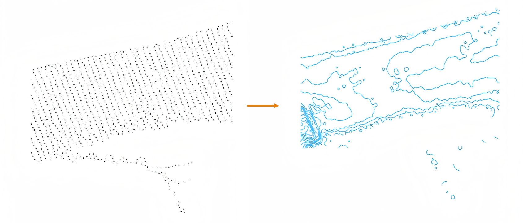
- After setting parameters, click Run to generate isobaths. Example:
- Verify results and use Append Features to integrate isobaths into chart groups. Note: Generated isobaths store depth values in the VALDCO field (standard field for nautical chart features). Field mapping is required during appending.
Related Topics