


Generate Depth Zone
Feature Description
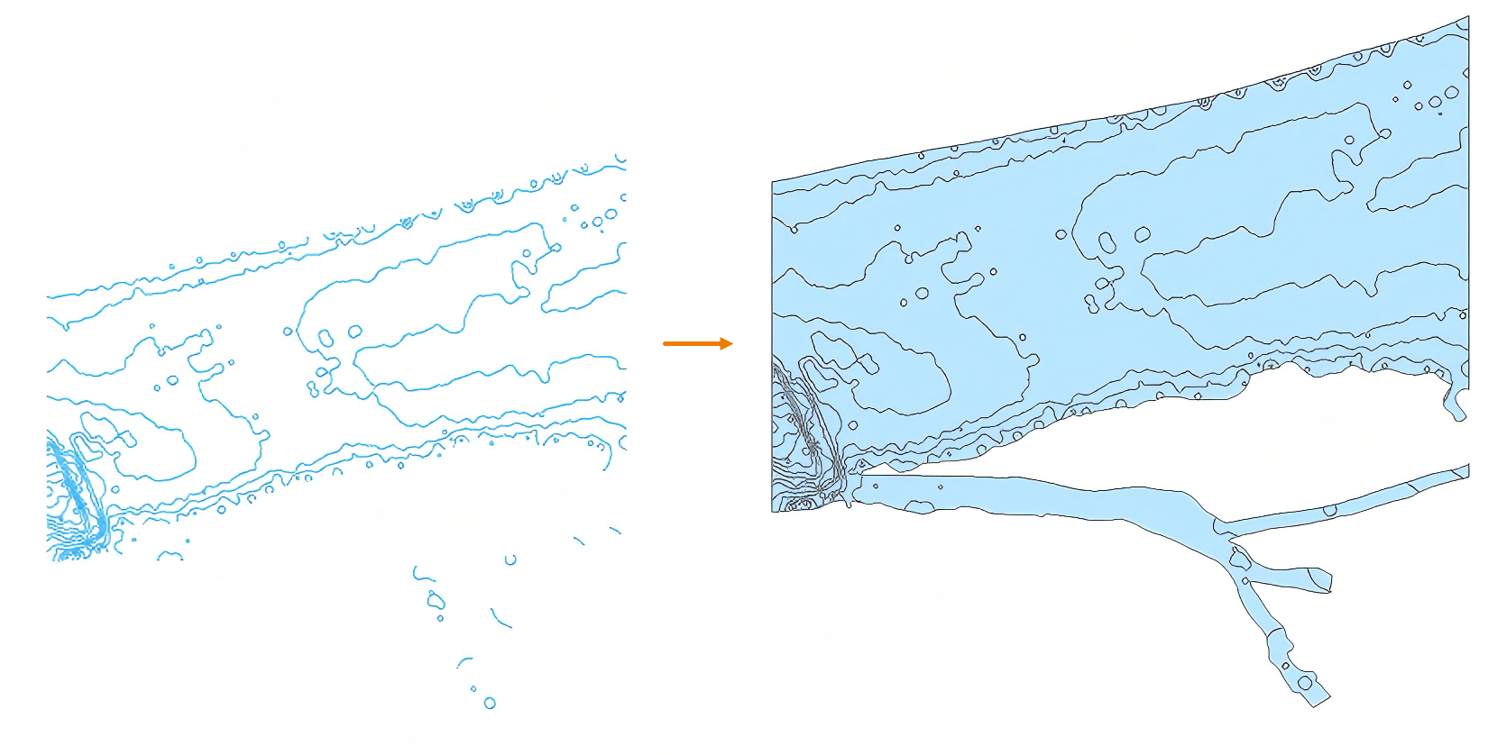
Generate depth zone is a crucial step in chart data preprocessing. It divides water areas into zones of different depths to provide intuitive distribution of water depths, allowing navigators and researchers to quickly identify water areas of varying depths. The generation of depth zones is based on existing isobath data to create polygonal features.
Steps
- Import the isobath line dataset used to generate depth zones.
- Chart Tab -> Chart Data Processing group -> Generate Depth Zone button to open the Generate Depth Zone dialog.
- Configure parameters:
- Source Dataset: Set the isobath data as source dataset, and configure the mandatory Property Field as the field storing depth values (e.g., VALDCO).
- Soundings: To prevent depth zone polygons formed by a single isobath from having equal maximum (DRVAL2) and minimum (DRVAL1) depth values (which would trigger S-58 data inspection error ID:1779), you can specify sounding data used to generate isobaths. After adding, the system will use these sounding points combined with adjacent depth zone data to determine whether the area is a "deep hole" or "peak".
Based on determination results, the system will automatically extract maximum or minimum depth values:
- For "deep holes" (higher values indicate deeper areas):
DRVAL1 directly uses isobath value;
DRVAL2 uses the deepest sounding point within the area. If not found, set to UNKNOWN. - For "peaks" (lower values indicate shallower areas):
DRVAL2 directly uses isobath value;
DRVAL1 uses the shallowest sounding point within the area. If not found, set to UNKNOWN.
- For "deep holes" (higher values indicate deeper areas):
- Water Area: Define water area to limit depth zone generation region, supporting complex control through filter expressions.
- Result Data: Set result dataset name and target datasource.
- Click Run to complete depth zone generation from isobath data. Example:
- After verifying generated depth zones, use the Append Features function to add them to chart groups. Note: Generated depth polygons automatically store maximum depth in DRVAL2 and minimum depth in DRVAL1. Field mapping is required during Append Features.
Related Topics