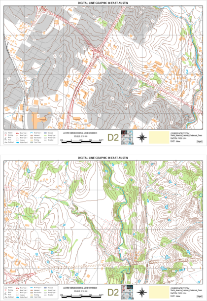
A map series is a collection of maps. iDesktop allows you to generate a map series by traversing a group of map ranges. For instance, you can create a group of sequential parcel maps and print them out.
Maps in a map series have the same layout, scale, and cartographic specification but different content in the same area. The advantages of creating a map series to output an atlas includes high speed of creating maps, high quality, the same style every paper map has, and so on.
In general, each page should have other elements like map titles and these elements should be changeable to suit every page.
 |
| An example of a map series |
The range of each map is determined by each element in a layer which we call an index layer. An index layer can divide a map into multiple parts. A map corresponds with an index object. The commonly used index layer is a polygonal grid index layer.
 |
| A map series based on a polygonal grid index layer |
The feature Create Grid Index can create an index layer. The feature Calculate Adjacent Field can create some fields which can be used for labeling adjacent pages.
Normally, each page of a map series composes of a title, a main map, a locating map, text, tables, and so on. iDesktop provides strong abilities to add abundant elements in a layout.
All of elements that can be added in a layout are classified into two classes Static elements and Dynamic Elements. Dynamic elements can change over the changing of page content like page number, locating maps which can help us locate and identify the spatial position of the current map in a larger area, and so on. The locating map will update automatically when the range of the main map associating with the locating map changes.
While static elements like a compass will not change automatically. Any change happened in a static element, related content on each page of a map series will change as well.
The created map series can be print out to be an atlas.
 Related topics: