Instructions
Both raster tiles and vector tiles saved in MongoDB can be published to map services, rest services, OGC services, 3D services or other services, and so on by SuperMap iDesktop.
Following operations should be performed first before publishing MongoDB tiles:
- Generate map tiles saving in MongoDB. For more detail, please refer to Map tiles.
- Boot iServer service by running startup.bat/startup.sh in the bin folder of SuperMap iServer.
- Start MongoDB service, please refer to MongoDB User Guide to start service. Note: the supported version is MongoDB 3.2.
Basic steps
- Click Online tab > Publish iServer Service group > MongoDB Tile button to open the dialog box Publish MongoDB Tiles.
-
iSever Address : Enter the iServer address. Click the drop-down button and select “New Connection”. In the pop-up dialog box, enter the service address, username, and password. The addresses accessed before will be saved automatically for further use. You can enter custom service addresses after the path iServer installation/webapps/iserver. Three iServer service address formats (localhost, http, and https) are compatible. The detail formats are:
- localhost:8090
- localhost:8090/iserver
- localhost:8090/userdefine
- http://localhost:8090
- http://localhost:8090/iserver
- http://localhost:8090/userdefine
- https://localhost:8443
- https://localhost:8443/iserver
- https://localhost:8443/userdefine
Note: If you do not start iServer service, you can not log in the service successfully.
3.Connect to MongoDB : Specify information for accessing the MongoDB server and databases. Starting the MongoDB service is a must. About how to start MongoDB services, please refer to ”MongDB User Guide”. The following content introduces all required parameters.
- Server Name : Enter the address of MongoDB server of saving map tiles.
- Database Name : Enter the database name of saving map tiles. When you start your MongoDB server successfully, all available databases will be listed in the drop-down list, and you can choose any one as needed.
- User/Password : Enter the username and password relative to the database you specify. If your database does not have a username, you can ignore the two parameters.
- Publish Map Service : The supportive map services include REST map services, OGC services and other services. For specific service description, please refer to Web Datasource Introduction.
- Map: Select tiles you want to publish. You can choose ALL from the drop-down list to publish all tiles in the newest versions. Or you can choose anyone to publish only the selected map tiles.
- REST Service: Map tiles can be published to a REST map service (map serivce or vector tile service). For details about types of REST services, please refer to REST Service.
- OGC Service: includes: WMS1.1.1, WMS1.3.0, WMS1.0.0, WMTS-CHINA. For specific instruction about OGC service types, please refer to OGC Service.
- Other Service: includes: ArcGIS REST Service, Google REST Service, Baidu REST Service.
ArcGIS REST Service has abilities to access maps and layers and perform relevant operations. Such as:
- Gets the list of maps or layers and views properties.
- Supports retrieving elements, adding elements, updating elements and deleting elements.
- Supports raster query, spatial query, range query and SQL query.
- Supports showing whole maps, overview maps and vector tiles and so on.
- Clears cached map images from the server.
- Publish 3D Service : Map tiles can be published to 3D services. Check the checkbox, all available map names in the current database are listed and you can select anyone as needed.
- Click “Publish” button. The Output window will show the service types and links.
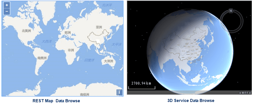
- Click on the rest map service link in the output window to head to the SuperMap iSever Rest page, and click on “maps” to view the published map list where you can choose one way to browse tiles.
- Click on the 3D service link to head to SuperMap iSever 3D service page, and click on “realspace” > “datas” to browse data in three dimensions.

