


Feature Description
Public transport data forms the core and foundation of public transport analysis. The required data for SuperMap public transport analysis includes bus stop dataset, line dataset, stop-line relationship dataset, stop-exit relationship dataset, and network dataset. Users must provide these five datasets, with the first three being mandatory for public transport analysis, while the stop-exit relationship dataset and network dataset are optional.
Data used for public transport analysis must undergo inspection and correction of non-compliant elements prior to analysis to ensure compliance with requirements.
Components of Public Transport Data
| SmUserID | Name | StopID | ... |
| 1 | Airport Front Station | 1 | ... |
| 2 | Lijiatuo | 2 | ... |
| 3 | Heping Street | 3 | ... |
| ... | ... | ... | ... |
| SmUserID | Name | LineID | ... |
| 1 | Route 11 | 1 | ... |
| 2 | Route 8 | 2 | ... |
| 3 | Changchun Light Rail | 29 | ... |
| ... | ... | ... | ... |
| SmUserID | LineID | StopID | ... |
| 1 | 18 | 1 | ... |
| 2 | 27 | 8 | ... |
| 3 | 15 | 13 | ... |
| ... | ... | ... | ... |
Stop-exit relationship dataset (optional): For stations with multiple exits (e.g., subway stations), this line dataset defines walking paths between stations and exits. As shown in Figure 1, transferring at Muxidi Station requires walking from subway exit A1, which can be guided by this dataset.
This line dataset must contain Stop ID and Exit ID fields. Exit names and pinyin fields may be included. Without this dataset, transfers assume straight-line connections or use network basemap data.
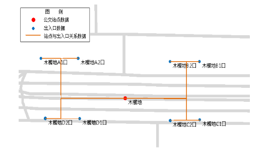 |
| Figure 1: Relationship Diagram of Stops and Exits |
- Bus stop dataset: Stores collected bus stops in a point dataset. Each point represents a physical bus stop. Different types of stops (e.g., bus stations, subway stations) may coexist. The attribute table must contain two mandatory fields: Stop ID (int/long type) and Station Name. The table below shows Changchun bus stop dataset attributes, where StopID represents station ID and Name indicates stop name.
- Line dataset: Stores collected transportation routes as line objects. Each line represents a complete directional route (one-way, two-way, or circular). For example, Route 123 from Terminal A to B and its reverse direction should be stored as separate line objects. The line direction corresponds to digitization direction.
The attribute table must contain Line ID (int/long type) and Line Name fields. Additional fields like departure time, fare information may enhance analysis capabilities. The following table shows Changchun line dataset attributes:
- Stop-line relationship dataset: A tabular dataset defining stop-line relationships. This prevents errors from assuming automatic spatial correlation between stops and lines. Each record indicates a directional line passes through a specific stop.
Mandatory fields include Line ID and Stop ID (int/long type). Sequential numbers indicating stop order along lines may be included.
- Network dataset (optional): Contains network topology for realistic walking path calculation during transfers. Without this dataset, Euclidean distance is used for walking estimates.
- Importing other data formats: SuperMap supports importing data formats like MapInfo TAB/MIF and ESRI Shapefile through its data import function, provided they meet analysis requirements after conversion to SuperMap datasets.
Data Inspection
Note: Inspection uses environment settings like station snap tolerance. Proper environment configuration is required before validation.
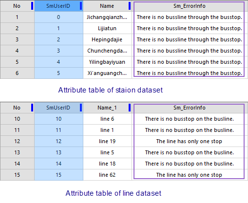 |
- SuperMap automatically validates data integrity through built-in checks when executing analysis. Errors will be recorded in "Sm_ErrorInfo" field across relevant datasets. Correct data is required for successful analysis execution.
- The system automatically adds "Sm_ErrorInfo" text field to record errors as follows:
Dataset Errors Description Stop dataset No lines pass through stop No related records in stop-line relationship dataset Duplicate ID Repeated Stop ID values Line dataset Line without stops No related records in stop-line relationship dataset Single-stop line Duplicate ID Repeated Line ID values Stop-line relationship dataset Missing stop Stop not found in stop dataset Missing line Line not found in line dataset Snap tolerance exceeded Stop exceeds maximum snap distance to line Stop-exit relationship dataset Missing stop Stop not found in stop dataset Spatial mismatch Line endpoints don't match corresponding stop positions
Data Modification
Identified errors must be corrected through iterative validation-modification cycles until no errors remain. Analysis functions will be blocked until all errors are resolved, with output windows directing users to review "Sm_ErrorInfo" fields.
Related Topics
Setting Public Transport Analysis Environment