


Calculate Bounding Rectangle
Feature Description
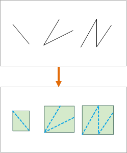
Calculate Bounding Rectangle creates bounds for objects in a line dataset or region dataset, generates a new region dataset, and transfers the original objects' attributes to the generated polygon features.
 |
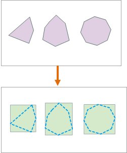 |
| Diagram of Bounds Generated from Line Dataset | Diagram of Bounds Generated from Region Dataset |
Application Scenarios
Applicable in AI remote sensing imagery information extraction, providing vector boundary bounds for target interests in object detection training sample data, facilitating information extraction for buildings, cultivated land, etc.
Feature Entry
- Data Tab -> Data Processing -> Vector -> Calculate Bounding Rectangle.
- Toolbox -> Data Processing -> Vector -> Calculate Bounding Rectangle.
Parameter Description
- Source Dataset: Select the dataset to analyze. Only line datasets and region datasets are supported; point datasets are not supported.
- Result Data: The result dataset is a region dataset. Attributes from source features will be preserved in corresponding polygon features.
- Decompose Subobject: When dealing with compound polygon objects or compound line objects in the dataset, supports setting whether to decompose them into subobjects.
- If checked: Decomposes compounds into multiple subobjects and generates a bounding rectangle for each subobject.
- If unchecked: Treats compounds as single objects to generate bounding rectangles.
Application Example
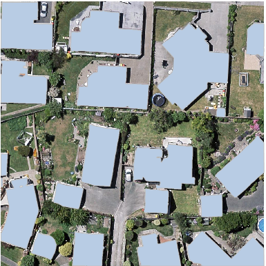
The object detection training procedure requires rectangular boxes of target interests as labels. Using Calculate Bounding Rectangle function to compute bounds of vector boundaries for target interests prepares label data for generating training data, producing results as shown below:
 |
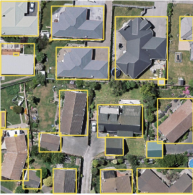 |
| Target Vector Boundaries | Calculate Bounding Rectangle Results |
Related Topics