


Labeling The Map
Map labeling helps quickly identify geographic elements. This example demonstrates labeling operations for Substation and TransferStation layers.
Labeling the Substation Layer
The Substation dataset contains station names in its property fields. Select the appropriate field for labeling.
- In Layer Manager -> Substation@Subway layer's context menu, select Create Thematic Map....
- In the Create Thematic Map dialog, choose Single symbol label thematic map -> Default from left panel. Click OK to switch to Thematic Map panel.
- The thematic map ribbon contains Properties, Style and Advanced tabs. This guide focuses on key parameters:
- Under Properties tab, set Label expression to Name.
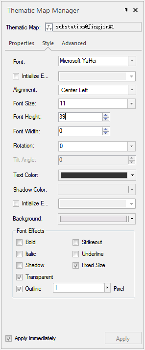
- Under Style tab, configure Font as Microsoft YaHei, Alignment as Center Left, and Font Size as 11. Refer to the illustration for other parameters:
Labeling the TransferStation Layer
The TransferStation dataset stores transfer station names in its property fields. Select the corresponding field for labeling.
The labeling procedure for TransferStation layer is identical to Labeling the Substation Layer.
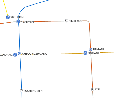
The labeling effects for both layers are shown in the following figure:
After labeling, click Start tab -> Workspace group -> Save button. Save the map as Chengdu Metro Map, then save both map and workspace.
Related Topics