Making 3D Ranges Map Based on Template
Instructions for use
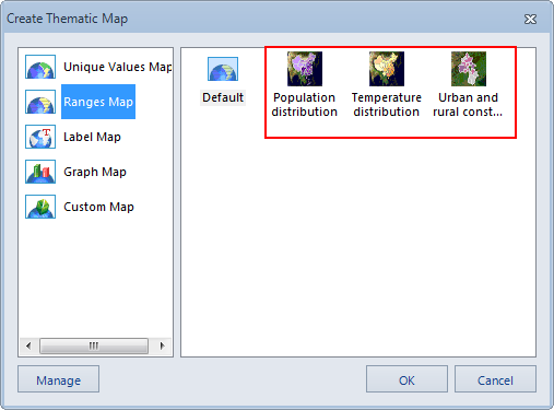
The options in the list on the right side of the Create Thematic Map function interface, except the Default option, are based on the existing 3D Ranges Map template to create a 3D Ranges Map for a 3D layer of Vector Dataset type.
Operation steps
- Sets the current layer to be the 3D layer of the Vector Dataset type of the 3D Ranges Map (except for the 3D layer of the Text Dataset type).
- Click the Thematic button in the Data group on the Scene tab of the ribbon.
- In the right area of the pop-up " Create Thematic Map" function interface, select the Thematic Map Template to be based on to apply the style in the template to create a 3D Ranges Map.
- The created 3D Ranges Map is automatically displayed as a thematic layer in the Add to Current scene, and a sub-node will be added under the "Normal Layer" node in the Layer Manager, which corresponds to the thematic map just created.
- The Thematic Map Template of the system and the Thematic Map Template of the User Custom will appear in the right area of the " Create Thematic Map" function interface. It can be managed uniformly through the Template Manager. Please refer to "Template Management" ".
 |
| Figure: Ranges Map Templates. |
 Precautions
After the Graudated Colors Map is made by using the "template", the "3D Ranges Map" window "will pop up at the same time. The setting information for making the current thematic map is displayed in the window, and the user can modify these settings. Therefore, users can modify the Graudated Colors Map based on the template to obtain a more ideal 3D Ranges Map.
 Related topics
 Save to Thematic Map Template Library


