


The Bounds section in Map Properties panel provides parameters related to visible bounds, including scale, visible bounds, center point, view extent, and map bounds.
Current Scale
Displays and sets the scale used in the current map. This value updates dynamically during map zoom operations.
Directly input desired scale values in the text box next to Current Scale.
Fixed Scale
When enabled, map zoom operations will switch between predefined fixed scales.
Click the Custom... button to open Custom Scale List dialog for scale management. See Custom Scale for details.
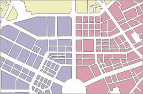
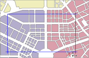
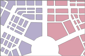
Clip Display Extent
Display only specified area content on the map.
Enable Clip Display Extent and select a clip mode from dropdown menu. Provides five modes: Select Object, Draw Rectangle, Circle, Sector, and Polygon. Select Object allows choosing one or multiple polygon objects as clip extent.
Requires reconfiguration when map's projected coordinate system changes.
 |
 |
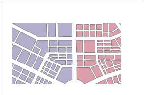 |
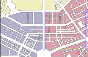
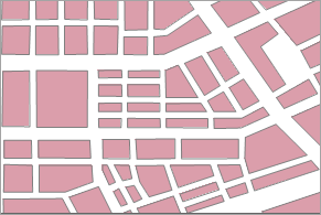
| Original Map | Define Clip Bounds with Rectangle | Clipped Map |
Lock Maximum Display Bounds
Specify maximum display area using Select Object, Draw Rectangle, Circle, Sector, Polygon, or Set as Map Bounds. The specified area will fill the map window, hiding external content. Once set, map scale cannot zoom beyond this maximum visible bounds.
Unlike clip display extent which allows free zoom/pan, locked bounds restrict all navigation within specified range.
 |
 |
 |
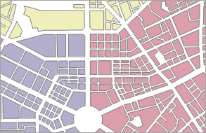
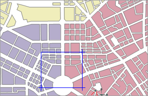
| Original Map | Define Locked Range with Rectangle | Locked Range Display |
Custom Full Bounds
When enabled, using Full View in context menu will display map within user-defined full extent.
 |
 |
 |
| Default Full View | Custom Full Bounds | Custom Full View |
Center Point
Displays/sets map center coordinates through X/Y values. Directly input new coordinates to reposition map center.
Current View
Sets current map's visible bounds, updating dynamically during navigation.
Three configuration methods:
- Whole Map: Sets visible bounds to union of all layers' extents.
- Custom Bounds: Two approaches:
- Select Objects: Use selected object(s) extent as visible bounds.
- Draw Rectangle: Define bounds through interactive rectangle drawing.
- Paste: Apply copied coordinate system information from other sources as visible bounds.
Map Bounds
Displays current map's spatial bounds information and minimum extent of datasets. Spatial range updates with dataset changes.
Related Topics
Map Properties - Coordinate System