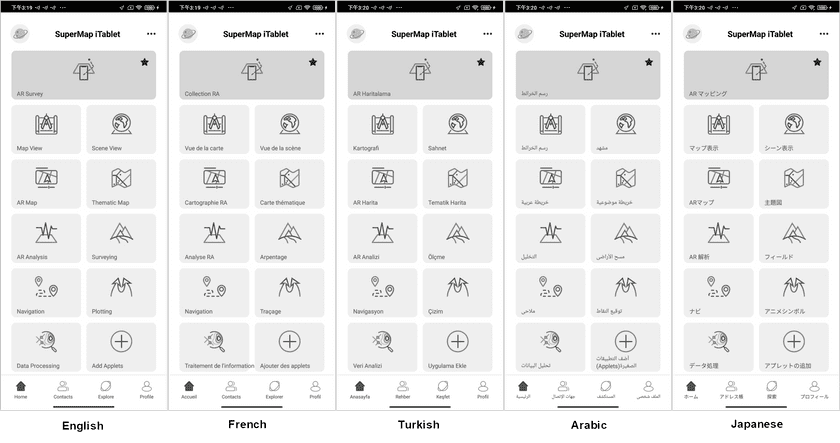
SuperMap iTablet 11i(2022) (hereinafter referred to as iTablet) is a professional GIS APP developed based on SuperMap iMobile. It provides robust ability to create maps and browse maps, 3D scenes, and AR maps online and offline. It can collect and analyze data. It supports emergency plotting. You can use the app directly to process, analyze, and collect GIS data without coding.
Download
SuperMap provides iTablet for both Android and iOS. You can download the app from Google Play or SuperMap official website.
Screen switching
iTablet can adapt the screen orientation of mobile devices.
Multiple languages
iTablet supports multiple languages including Chinese, English, Japanese, French, Arabic, and Turkish.
Product features
Coverage GIS common directions
iTablet provides 10 functional modules. It supports professional data collection, data analyses, and thematic cartography. It allows users to browse maps and scenes and process data. The combination of AR and AI makes the data collection and target recognition more simple and advanced. It is very friendly for users that want to know GIS and use GIS.
Resources sharing between cloud side and end side
iTablet supports the access of SuperMap Online and SuperMap iPortal, thereby managing and using services, data, labels, maps, scenes, base maps, symbols, and templates saved on cloud side. It allows users to create groups, and so users can cooperate with friends and share resources. It supports online/offline messages sending and files transmitting. Besides, you can add, search, and manage friends.
Swipe to operate maps
iTablet enables users to operate maps and process data with fingers.
Access multi-source data
iTablet supports various data. Apart from workspaces, datasources, and datasets, it supports adding maps from MapWorld, OpenStreetMap, AMap, etc. as base maps and loading map services. Besides, it allows to import image data in the format of tif or img, vector data in the format of shp or mif, and data in the format of kml, kmz, and gpx.
Add applets
iTablet advanced version provides the ability of extension development as well. Users can develop applets based on JavaScript programming language. After development, you can add your applets on the Home page to use them directly. Note: please develop applets based on iTablet advanced frame, using JavaScript language, deploying them in the app as plugins.

