


TIN Clip
Usage Instructions
To support the use of terrain tiles (TIN) generated from DEMs, various clipping operations can be performed on terrain tile (TIN) data to make better use of the data. The TIN terrain clipping operation allows you to perform area‑based clipping on a specified TIN terrain in the scene window using a defined range.
Access
- 3D Geographic Design tab → TIN Terrain operations → Clip
- Toolbox → 3D Data → TIN Processing → TIN Clip
Steps
- Load the terrain tiles (TIN) in the scene (configuration file format *.sct).
- In the Layer Manager, select the terrain tile layer, right‑click and choose "Zoom to Layer". Adjust the camera view in the scene window using the mouse wheel to a perspective convenient for operation.
- On the 3D Geographic Design tab, in the TIN Terrain Operations group, click the Clip item to open the "TIN Clip" panel.
- Layer selection: Click the drop‑down arrow in the "TIN Terrain" combo box and select the layer containing the object to be clipped.
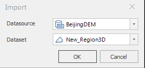
- Define clipping region: Select either "Select Region" or "Draw Region" to determine the clipping region type. When "Draw Region" is selected, the toolbar provides three methods for drawing the clipping region: "Rectangle", "Polygon", and "Import". Clicking the Import button opens a dialog box where you can import 2D/3D regions as the clipping region.
- "Preview" check box: The "Preview" check box is checked by default, allowing real‑time preview of the clipping effect.
- Parameter settings:
- Clip Mode: Click the drop‑down arrow in the "Clip Mode" combo box and select either "Keep Inside" or "Keep Outside". The "Keep Inside" mode extracts the terrain tiles (TIN) inside the closed region, while the "Keep Outside" mode extracts the terrain tiles (TIN) outside the closed region.
- Clip Boundary Elevation: Click the drop‑down arrow in the "Clip Boundary Elevation" combo box and select either "Same as Original Data" or "Same as Clipping Region". "Same as Original Data" keeps the boundary elevation values of the clipping result unchanged from the original; "Same as Clipping Region" makes the boundary elevation of the clipping result consistent with that of the clipping region.
- Result data settings: If you do not wish to modify the original terrain tiles (TIN), you can specify the storage path and name for the result data in the Result Data section, then click "Save As" to perform the clipping and save the result data.
- Click "OK" to perform the TIN terrain tile clipping. You can also use the "Undo" button to roll back to the most recent historical operation.
 Note:
Note:- When the Clip Boundary Elevation is set to "Same as Original Data", the Z‑value of the clipping region has no effect.
- After performing a clipping operation on terrain tiles (TIN), the software retains historical data records. You can view and roll back historical data using the history option in the terrain tile right‑click menu.