


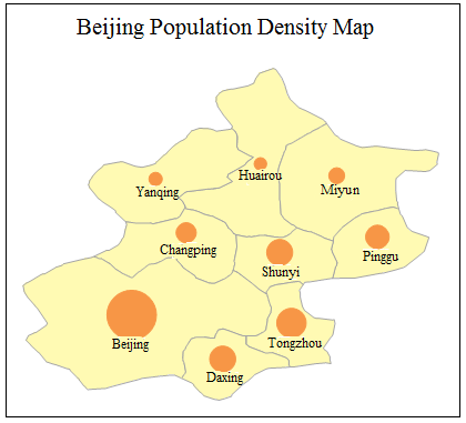
Similar to graduated color thematic maps, graduated symbol thematic maps categorize selected attribute fields of vector layers into different grades. Each grade is represented by point symbols of varying sizes proportional to the attribute values - larger symbols indicate higher values and vice versa. This thematic map type is particularly suitable for visualizing quantitative characteristics such as grain production, GDP, and population distribution across different regions.
Click the Graduated Symbol Thematic Map button in the Thematic Map tab to generate a default-styled map. Customize parameters through the graduated symbol thematic map window to create personalized maps. The following illustration shows a graduated symbol thematic map of historical earthquake magnitudes in Shanxi Province, where larger symbols represent higher magnitude levels.
 |
Graduated symbol thematic maps can be created from point, line, or polygon vector layers. To begin, set the target vector layer as current by selecting it in the layer manager.
Methods to Create Graduated Symbol Thematic Maps
 Create a Graduated Symbol Thematic Map
Modify Graduated Symbol Thematic Map