


Orthorectification Production Workflow
The Orthorectification Production Workflow used to perform orthorectification on raw imagery, output as orthorectified results for one or multiple independent scenes. It is suitable for scenarios where the core rigid requirement is obtaining accurate geographic coordinates and true shapes of surface features, with no additional demands on visual appearance, spatial detail, or color aesthetics.
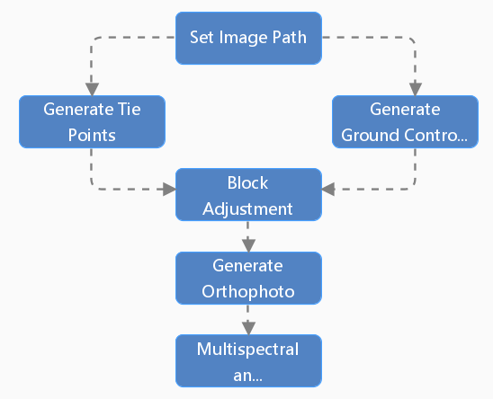
- Set Image Path: Specify the processing paths for raw imagery, reference imagery, and result data. Supports filtering and pairing of raw panchromatic and multispectral images.
- Generate Tie Points: Automatically generates tie points in overlapping image areas for mosaicking and block adjustment of multiple satellite images, ensuring geometric consistency among them.
- Generate Ground Control Points: Generates Ground Control Points based on image feature points for high-precision geometric correction and geolocation, ensuring the geographic positional accuracy of the imagery.
- Block Adjustment: Calculates the orientation parameters of the satellite images through adjustment computation based on the tie points and ground control points.
- Generate Orthophotos: Orthorectifies the imagery to remove geometric distortions caused by terrain relief and sensor attitude, producing a panchromatic orthophoto.
- Multispectral and Panchromatic Registration: Registers the multispectral imagery to the corrected panchromatic image, ensuring precise spatial alignment between the panchromatic and multispectral data.
 |
| Figure: Orthorectification Production Workflow |