


In the geographic world, roads are often abstracted as line objects (in rare cases, roads are also abstracted as area objects). Narrower roads can be represented by single lines, while wider roads may be considered to be represented by double lines. When labeling roads using road names, two issues need attention: during labeling, labels should follow the road direction and be placed on the road; for shorter roads, their names also need to be displayed.
This document introduces how to label roads using label thematic maps through an example of urban road label alongline.
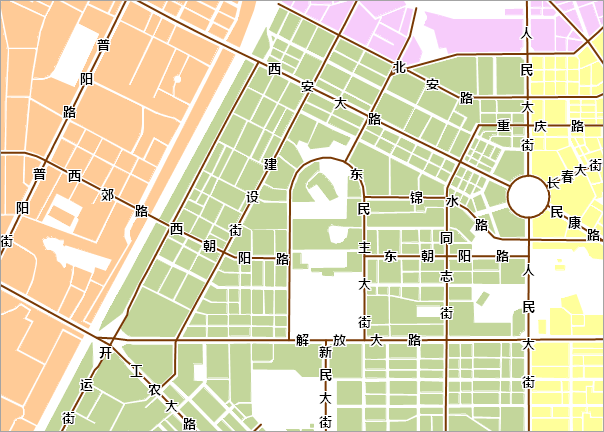
This application example includes three main parts: data preparation, creating label thematic maps, and map beautification. By performing thematic production in the desktop application system, the label alongline for the city is completed, and after adding map surround elements, the map as shown below is obtained:
 |
The following steps can be followed to complete this example:
Step 2 Creating Road Label Thematic Maps
Step 3 Configuring Basemap and Map Surround Elements