


A Unique Value Thematic Map utilizes the attributes of a certain field (or multiple fields) in a layer to represent differences between different attribute values through different symbols (line types or symbols). Unique Value Thematic Maps support the creation of Unique Value Thematic Maps for DEM layers and GRID layers. Unique Value Thematic Maps help emphasize type differences in data but cannot display quantitative information. Therefore, Unique Value Thematic Maps are often used for maps with categorical attributes, such as land use types, boundaries, and administrative division maps.
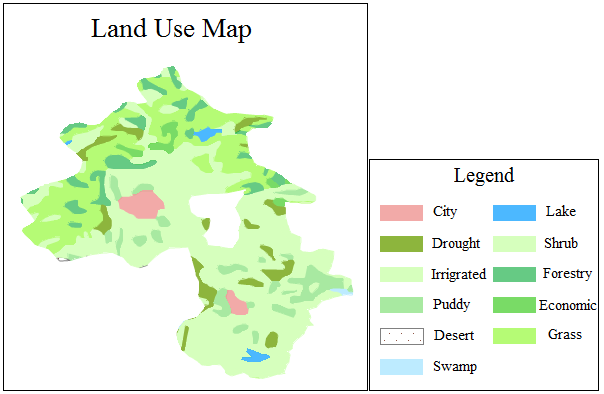
Click the "Thematic Map" tab's "Unique Value Thematic Map" button to directly generate the system-default Unique Value Thematic Map. Users can then modify parameters to create a Unique Value Thematic Map that meets cartographic needs. The figure below shows a schematic diagram of a Unique Value Thematic Map, which is based on a land use type property field, where different colored fill areas represent different land use types.
Unique Value Thematic Maps can be created based on any point, line, or area vector layer. When creating a Unique Value Thematic Map, first set the vector layer for which you want to create the thematic map as the current layer, that is, select the vector layer in the layer manager. Additionally, the created thematic map can be edited.
Specifically, for a Unique Value Thematic Map of a point dataset, if the unique values style uses symbols, marker size and rotation angle support selecting property fields for custom single-value styles.
A Unique Value Thematic Map can only be created using the above method when the thematic value items of the layer do not exceed 3000. If the thematic value items exceed 3000, the application will not perform the creation of a Unique Value Thematic Map.
For more information on thematic map editing, please refer to Editing Thematic Maps.
This chapter will introduce the following content:
- Creating a Unique Value Thematic Map: Introduces the methods and related precautions for creating a Unique Value Thematic Map.
- Modifying a Unique Value Thematic Map: Introduces how to modify various parameters of a Unique Value Thematic Map to better meet requirements.