


Extract Data
Feature Description
The Extract Data feature supports exporting the boundary polygon formed by registered video control points as vector region datasets or point datasets. When opening a video in a map or scene, the extracted vector data can be used to locate the position of the video dataset.
Feature Entry
- Video Maps Tab->Manage Video Group->Extract Data->Extract Point/Extract Polygon Data (The Video Maps tab is only available when the current window is a video map)
Steps
- Click the Video Maps Tab->Manage Video Group->Extract Data button to open the Extract Data dialog.
- Select Extract Point or Extract Polygon Data, then configure the source data and target dataset in the dialog.
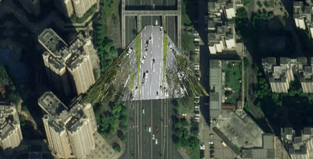
- The following figure shows the extracted polygon data.
 Notes:
The dataset must be a registered video dataset.
Related Topics