


The full name of S-102 is Specification for Surface Products for Water Depth (Bathymetric Surface Product Specification). Also known as the S-102 Bathymetric Surface, it is intended to standardize the representation of high-resolution seafloor Terrain Data.
S-102 provides a standardized format for storing and transmitting Subsea Elevation Data, supporting applications such as marine navigation, environmental monitoring, and marine engineering. These data are presented in a regular grid structure, allowing for an accurate depiction of the seafloor topography, supporting safer and accurate navigation.
- Storage Format: S-102 data is usually stored in grid format ( *.h5 ), which is a kind of Coverage data and stores water depth values. This format organizes the Seabed Elevation Data into a regular two-dimensional grid, with each grid cell containing the seafloor depth value at the corresponding location. The data files follow a specific coding structure to ensure compatibility with other marine data standards.
- Data content: S-102 data is a high-resolution digital model of seabed topography. Display Effects is similar to a topographical map, where changes in the height of the seafloor are represented by color gradients or contours.
- Relationship to the S-100 standard: The S-102 is primarily used to provide detailed bathymetric data for improved Electronic Chart Display and Information System (ECDIS) navigation accuracy. It is an important part of the S-100 framework and is used in conjunction with other standards, such as the S-101 Electronic Chart, to improve the overall functionality and accuracy of the navigation system.
- Relationship to S-101: S-101 is the Chart Data standard, which is mainly used to describe various information required for ocean navigation, including water depth data. The water depth data in S-101 is usually in the form of point data, which provides the basic information needed for navigation safety. Unlike S-101, which focuses on navigation safety information, S-102 provides more detailed seabed Elevation Data, showing more detailed seabed topography. S-102 is mainly used to enhance the spatial accuracy and detail of Chart Data, and is an important supplement to S-101 data.
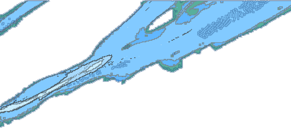 |
| S-102 Water Depth Surface Diagram |
SuperMap iMaritimeEditor supports the import and display of S-102 Water Depth Surface Data. In this section, you will learn the following:
- Open S-102 data : Describes how to import *.h5 files that follow the S-102 product specification.
- S-102 Data display: describes how to display Chart Data by setting the Water depth mode . At the same time, it supports the setting of shallow water, deep water and safe contour values.
- Water depth query : to introduce how to inquire the water depth value of S-102 water depth surface.