


Linear symbols play a skeleton role in the map, which is one of the main carriers of Map Information, such as roads, rivers and so on. It should be highlighted as a key element in map design. Linear symbols are very narrow and slender, and only through the emphasis of color can linear symbols be highlighted. Therefore, when designing linear symbols, the color with high saturation should be selected for the line part. Different grades of linear symbols should be colored with different hues, lightness and saturation. Different grades of roads, such as expressways, national highways, provincial highways and county and township roads, need to be distinguished by different colors. There are also some lines that can use spot colors, such as city subway lines and contour lines. Below, we will focus on the color design of several common linear symbols in maps.
Road
The road color design mentioned in this article is based on the gray color of the map base map, which is also commonly used in the color design of the base map. If the color of the base map is dark, it may not be applicable. This requires the cartographer to match the appropriate road color according to the color of the specific base map, so as to achieve the coordination of the overall map color.
Map Hui, Baidu, Sky Map, Tencent and other Online maps color different levels of roads at 1:50 km. Map Hui, Baidu and Tencent all use yellow color system for road coloring. According to Road Grade, the color is from dark to light. Sky Map uses purple for the Color Settings of highways, and other levels of roads are also represented by yellow.
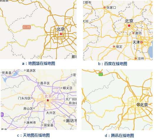 |
| Figure: Coloring of different levels of roads in Web map |
Map Hui, Baidu, Sky Map, Tencent and other Online maps color different levels of roads at 1:2 km. Compared with the previous picture, the roads under this scale are more abundant. Highways, national highways, provincial highways and other roads are displayed in a double-line way, and the main color system is still yellow. On the Color Settings of the double line, the color of the side line is darker than main color in the middle. The two colors still belong to the same color system, but there should be a contrast.
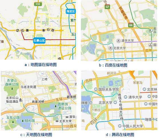 |
| Figure: Coloring of different levels of roads in Web map |
From the previous description, it can be seen that the Color Settings of expressways, national highways, provincial highways and county and township roads are mainly yellow. Because yellow gives people a sense of lightness, hope and vitality, the road line can be said to be the most displayed linear symbol on the map. The lightness and vitality of the color can not only increase the beauty of the map, but also bring people a sense of pleasure.
Of course, not all road lines can be represented by colors in the yellow color system at all scales. When dense city street lines appear and the focus is not on the performance of street lines, some colors with lower saturation can be used to reduce the visual effect of road lines, such as gray color system.
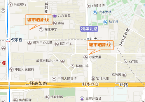 |
| Figure: Color design of city street lines |
The picture above shows the color design of city street lines at different scales. For a single line, the setting is gray (H = 0, S = 0, B = 79), and for a double line, the side line is gray and the dominant color is white. Urban roads are generally crisscrossed, including various streets and alleys, and the use of low-saturation colors can reduce the visual impact and make the map more readable.
Railway
In Digital Map, railway lines are generally represented by gray and white symbols, so the color design is not complicated, just two colors, gray and white. In the following figure, the gray of H = 0, S = 0, B = 79 is used, and the brightness value (the value of B in HSB) can be adjusted to match the color of the whole map.
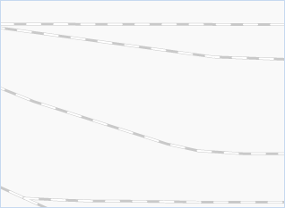 |
| Figure: Railway line |
River
People's perception of the color of rivers and lakes is generally blue, rather than yellow, green or Other Color (related to many factors such as the environment, not detailed here) that we see in real life. Therefore, in Digital Map, the color design of rivers and lakes is mainly blue. Different levels of river lines can be represented by blue with different saturation and brightness, while in the public Digital Map, they are generally represented by a blue color with moderate saturation, as shown in the following figure.
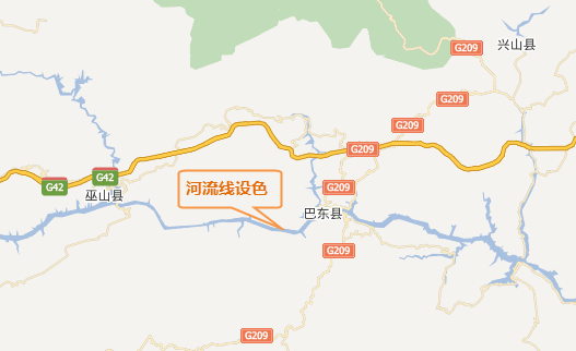 |
| Figure: River color design |
In addition to the color design of roads, railways and rivers, there are also the color design of border lines and administrative divisions (provinces, cities, counties, etc.). The color design of border lines and administrative divisions is generally gray, but if we want to distinguish between China and other countries in the border line, the border line of China can be expressed by other colors. For example, the yellow color system is used in Tencent Maps; the administrative divisions of provinces, cities, counties, etc. Are the representations of administrative divisions of different levels, which can be represented by colors with different saturation and brightness in the same color system, or by different line symbols.
 Related content:
 The Basic Characteristics of Color and Color Psychology