


Isolines from Click
Instructions for use
The Isolines from Click extracts all isolines equal to the elevation value at the mouse click position.
- The Source Dataset used to extract the contours must be a DEM or Gird Dataset.
Application Example
Open the Terrain "Datasource under the Exercise Data/Raster Analysis folder, and there is DGM data with a resolution of 5 meters, which we will use as an example.
Function entrance
- On the Spatial Analysis tab-> Raster Analysis-> Surface Analysis-> Isolines from Click;
Operating instructions
- Move the mouse to the map. At this time, the mouse status will turn into a cross. Click on the map to select one or more points to extract the isoline, as shown in the following figure:
- After selection, right click to pop up the Isolines from Click "dialog box, in which the coordinate value and grid value of the selected point are displayed;
- Set public parameters for extracting contours, including resampling coefficient, smoothing method and Smoothness in Target Dataset and Parameter Settings. For a description of the parameters, see Public Parameter Description .
- Click the "OK" button to complete the contour extraction operation. The result is shown in the following figure.
 |
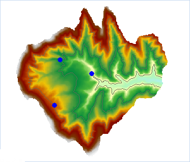 |
| Figure: Isolines from Click result |
 Related topics