There are many types of thematic maps, but most of them are composed of geographical basis and thematic content. The geographical basis is a part of the content elements on ordinary maps, such as latitude and longitude networks, water systems, residential areas, traffic lines, terrain, etc. The geographical basis serves as the skeleton for compiling thematic content, and represents the geographical location of thematic content and explains the relationship between thematic content and the geographical environment. Which basic geographic elements are represented on thematic maps and the level of detail vary depending on thematic content.
Thematic content, firstly displays one or several elements in a relatively complete and detailed manner, while placing other elements in a secondary position or omitting them, such as traffic maps; secondly, it displays thematic elements that cannot be seen on the ground or cannot be directly measured, such as population density maps.
 ArcGIS Thematic Map
ArcGIS thematic maps are produced by symbolizing the map. After configuring the map, the point, line, and region elements in the layer can be symbolically set, and information can be classified to create unique thematic maps and range thematic maps. In addition, it also supports the production of statistical thematic maps, density thematic maps, scatter distribution maps, and multi-attribute change maps. Thematic maps can also be customized for different industries.
 SuperMap Thematic Maps
SuperMap iDesktopX provides the function of creating thematic maps based on vector and raster data. The supported thematic map types include: unique, range, label, statistics, grade symbol, point density, custom, raster unique and raster range. For details, please refer to Thematic Expression.
SuperMap iDesktopX provides a variety of thematic maps for vector and raster data. Thematic maps are suitable for point, line, region, composite and raster datasets. Text datasets and image datasets cannot be used to create thematic maps.
The thematic map types applicable to vector data include: unique thematic map, range thematic map, label thematic map, statistical thematic map, graded symbol thematic map, point density thematic map, custom thematic map; thematic maps suitable for raster data include: raster range thematic map, raster unique thematic map.
 Supported ArcGIS Thematic Maps
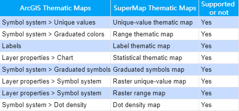
SuperMap iDesktopX supports the production of most ArcGIS thematic maps, such as label thematic maps, unique thematic maps, range thematic maps, statistical thematic maps, graded symbol thematic maps, and point density thematic maps. For detailed support information, please refer to the following table:

 Thematic map replacement effect
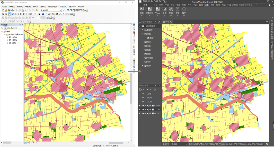
With the function of SuperMap iDesktopX thematic map production, various ArcGIS symbol setting effects can be migrated to complete thematic map production. The following picture is the migration effect of unique thematic maps:

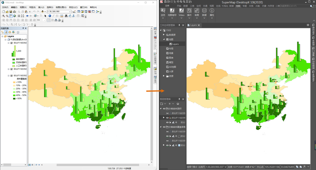
The following picture is the migration effect of statistical thematic maps:

 Related Contents