Map symbols are the basic means of representing map content. They are composed of graphics and text of different shapes, sizes, and colors. Map symbols belong to a graphic language. Compared with text, its biggest feature is its intuitive image. As far as a single symbol is concerned, it can represent the spatial location, size, quality and quantity characteristics of something. In terms of similar symbols, it can reflect the distribution characteristics of various elements. The sum of various types of symbols can indicate the interrelationships between elements and the overall characteristics of the region. Therefore, map symbols not only have the basic function of determining the spatial location, distribution characteristics, and quality and quantity characteristics of objective things, but also have the special function of interconnecting and jointly expressing the overall elements of the geographical environment.
 ArcGIS Symbols
According to the type of geometry drawn by the symbol, ArcGIS symbols can be divided into four categories: markers, linear symbols, filling symbols, and text symbols. Combining multiple symbols together is collectively called a style, and the style is saved as a single file (*.style).
- Makers: Used to draw point features and point graphics.
- Linear symbols: Used to draw linear data such as transportation networks, water systems, boundaries, subdivisions, and other connected networks.
- Filling symbols: Used to draw polygon features such as countries, provinces, land use areas, habitats, parcels, and outlines.
- Text symbol: Used to draw labels, annotations, titles, dynamic text, descriptions, annotations, legends, scale bars, graticule labels, tables and other text and table information on maps.
 SuperMap Symbols
SuperMap iDesktopX provides a rich symbol library, including more than 1,000 point, linear, filling symbols and three-dimensional effect symbols. It also supports the production of two-dimensional and three-dimensional map symbols, and has powerful symbol production and management functions. You can use the symbol library to organize and manage various symbol resources.
Symbols are divided into three types: point symbols, linear symbols and filling symbols. It supports setting multiple symbol styles, setting symbol color, outline, linearity, etc., and restoring them with one click. At the same time, it supports complex hierarchical settings of symbols to facilitate unified editing, browsing, and hiding operations. And symbol customization is allowed according to different user needs.
Supports importing the generated map symbols in SVG format, and you can zoom them arbitrarily without affecting their qualities. SuperMap iDesktopX currently provides more than 500 symbol resources in SVG format. The symbols are integrated into the symbol library and used directly for mapping. Symbol vectorization solves a series of problems such as blurry icons on high-resolution screens.
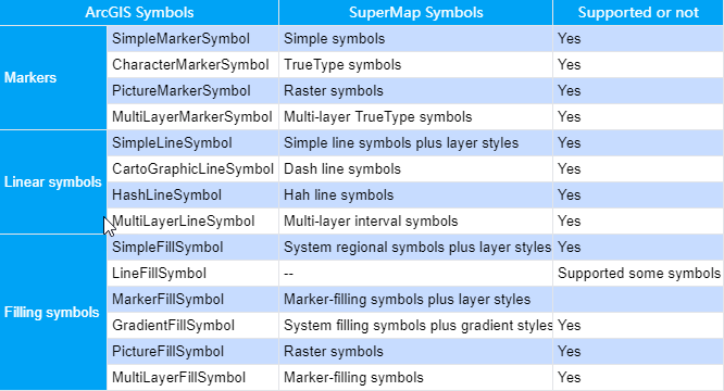
 Supported Symbol Types

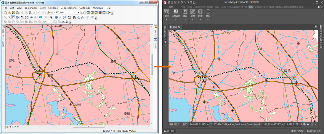
Point/line symbol migration comparison:

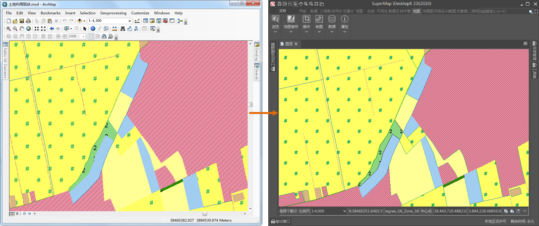
Fill symbol migration comparison:

 Symbol Library Migration
SuperMap iDesktopX supports migrating symbol information from the ArcGIS platform and batch conversion of symbol library files (*.style) provided by ArcGIS into SuperMap point symbol library (*.sym), line symbol library (*.lsl) and filled symbol library (*.bru). It provides an efficient and fast symbol style migration method to facilitate you to quickly configure styles.
Functional Entrance
Data Migration >ArcGIS Data Migration > Symbol Library Migration.
Parameters
- Style Folder: Specify the ArcGIS symbol library folder.
- Target Folder: Specify the destination storage folder after migration.
Convert the *.style symbol library to the SuperMap symbol library format. After conversion, files of three symbol library types: point, line, and regional are generated.
 Related Contents