


Feature Description
Linkage is a key feature of dynamic segmentation. After generating spatial data, a dynamic segmentation relationship is established among the route dataset, event table, and generated spatial data. Due to this relationship, modifying any one of the three will automatically trigger corresponding changes in the others according to predefined rules. This linkage facilitates modifications to event tables and spatial data. For more details about dynamic segmentation relationships, see Dynamic Segmentation Relationship Overview.
The dynamic linkage among the three can be categorized into the following scenarios:
- When descriptions in the event table change, linkage occurs between the event table and spatial data.
Modifying event table descriptions refers to updating general fields (excluding route ID and measure fields), such as temporary road closures due to weather or construction. Changes to descriptions in the event table will automatically update corresponding attributes in the spatial data. Similarly, editing general property fields in the spatial data's attribute table will dynamically update the associated event table.
- Dynamic changes occur between the event table and spatial data when event route positions are modified.
Modifying event positions refers to updating measure values in the event table or spatial data. If a measure value in the event table is changed, the corresponding spatial data's geometry and measure fields will update accordingly. Conversely, altering measure values in the spatial data's attribute table will dynamically adjust both the geometry and related event table entries.
For line events, modifying start/end measures changes event length and position. As shown in Figure 1, after adjusting the first event's measures from (20.78,79.37) to (150.00,180.00) in the event table, the corresponding spatial data updates automatically.
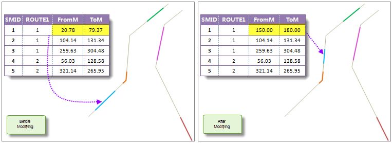
Figure 1: Modifying measure values in the event table Note: If modified measures fall outside the route's M-value range (e.g., new measures 26-60 vs. route range 3-20), spatial data geometry remains unchanged. Partial overlaps will update only valid portions, while exceeding the route's maximum measure will fail.
-
Spatial data updates when route data changes, but route data remains unaffected by spatial data modifications. Linkage occurs between event tables and spatial data.
This applies when route errors or changes require event relocation:
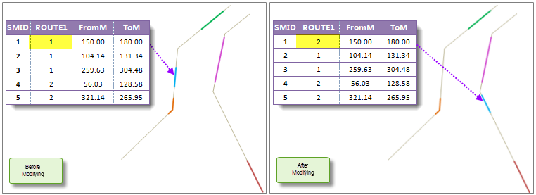
Figure 2: Modifying route IDs in the event table - Changing a route ID in the event table updates both geometry and route ID fields in spatial data. As shown in Figure 2, changing the first event's route ID from 1 to 2 relocates its spatial data to route 2.
- Modifying route IDs in spatial data updates both event table entries and spatial data geometry.
Steps
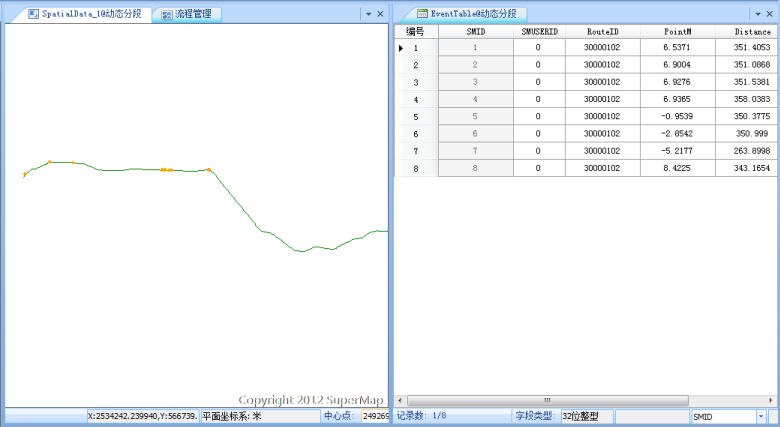 |
| Figure 3: Dynamic Segmentation Relationship Linkage Window |
- In the "Dynamic Segmentation Relationship Management" dialog, select a relationship and double-click to open the linkage window (Figure 3). Alternatively, click "Edit" in the management window. For management functions, see Dynamic Segmentation Relationship Management.
- The linkage window displays route data and spatial data. Modifications to event tables, spatial data, or route data will trigger real-time updates per described scenarios.
- Click "Close" to exit after completing operations.