


Question Catalog
1. How to view image file information?
2. How to view the raster values of areas with no value in the image?
Answers
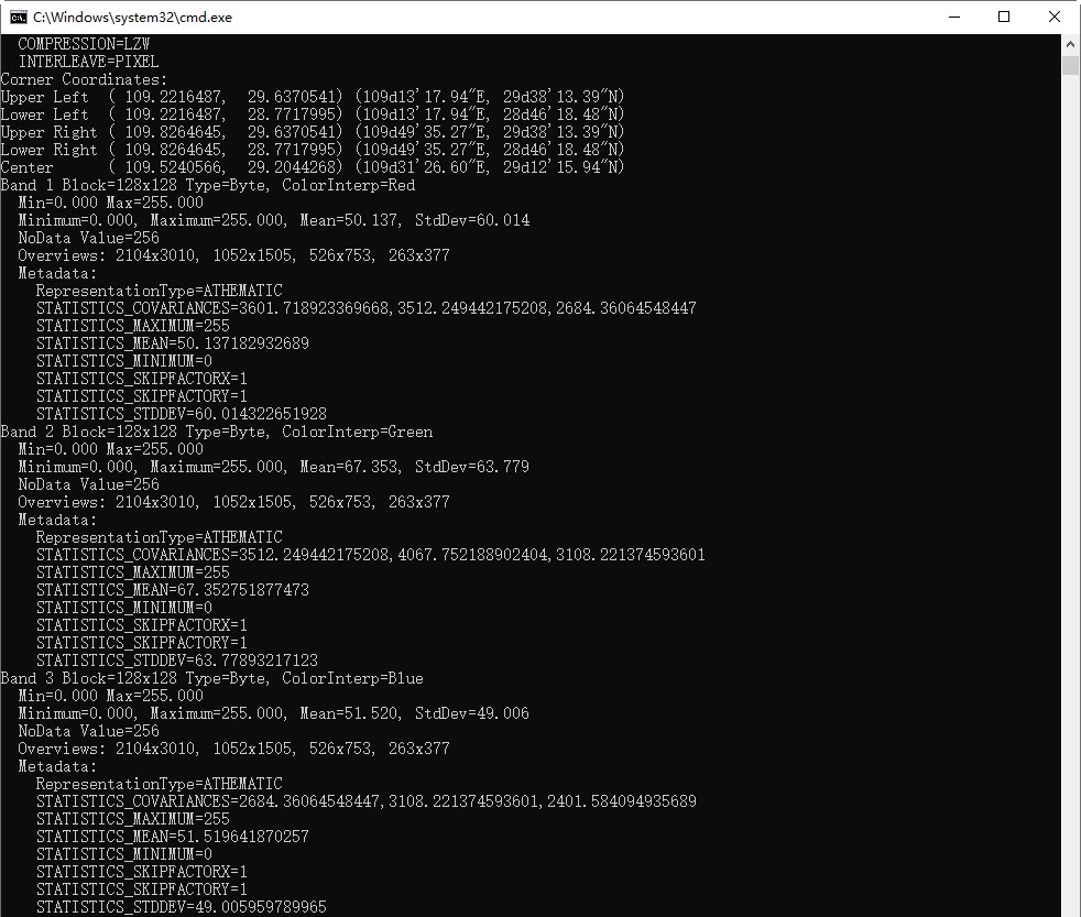
How to view image file information?
Answer: Use the gdalinfo.exe tool, located in the software installation directory \support\MiniConda\conda_mini\Lib\site-packages\osgeo\. The specific steps are as follows:
- Open the command line window
- Change the current directory to: Desktop installation directory
\support\MiniConda\conda_mini\Lib\site-packages\osgeo\ - Run the command:
gdalinfo.exe image file full path, for example:gdalinfo.exe E:\data\raster.tif - The result will be shown as follows:
How to view the raster values of areas with no value in the image?
Answer: Use the raster query function, located under Spatial Analysis -> Raster Analysis -> Raster Query. Click on Raster Query, and move the mouse to the areas with no value in the image. You will be able to see the raster values of each band of the image, as shown below:
- Based on the mosaic dataset query raster values
- Read-only open the image file to query raster values
After enabling no-value for the mosaic dataset, the default no-value areas of the image do not have transparency.
Answer: The existing mosaic dataset map has a default no-value region with no transparency, caused by an abnormal condition where the image contains no-value information. As shown below, the image file's no-value information error results in the default no-value for the mosaic dataset being the raster value of the non-no-value area. When opening the mosaic dataset, the no-value default for the image layer will adopt the mosaic dataset's no-value.
When modifying the mosaic dataset's no-value and enabling it to replace the erroneous image no-value, this modification will not be applied to the existing mosaic dataset map. You need to manually modify the image layer's "no-value (RGB)" to the correct value. Alternatively, you can reopen the mosaic dataset after modifying the no-value configuration, where the default no-value area will be removed.
After enabling no-value for the mosaic dataset, why must all mosaic dataset maps or images be closed before recalculating histograms, statistical data, etc.?
Answer: After closing the mosaic dataset map or image map, the program will rewrite the current image's statistical and histogram data to the aux.xml file. When the image is displayed next time, the histogram or statistical data from the aux.xml file will be used by default.
After enabling no-value for the mosaic dataset and recalculating the histogram and statistical data, the image's aux.xml file will be updated with the correct information. At this point, if the image map with the erroneous histogram and statistical data is closed, the incorrect information will overwrite the newly generated correct data.
Related Topics
View Mosaic Dataset Properties