


Feature Description
A feature is an abstraction of real-world phenomena, which can be a type or an entity, such as buildings, coastlines, lakes, or other ground objects and natural landforms, as well as ENC metadata like data coverage extent and depth quality.In S-101 chart production, feature datasets are crucial. SuperMap supports creating new feature datasets in an editable chart group based on specified feature codes and types.
The feature data dictionary provided by SuperMap follows the IHO S-101 standard and includes feature names, codes, types, definitions, and related remarks, which can be conveniently used to create feature datasets. These datasets are widely used in chart production for feature identification, update data, and chart sheet generation, ensuring data consistency and accuracy.
Function Entry
- Layer Manager -> Right-click the S101 layer group -> Create Feature Dataset....
Operation Steps
After opening an S-101 chart sheet in edit mode into the map, you can select non-spatial layers of objects or objects in the Layer Manager, right-click and choose Feature Object Management, and maintain the non-spatial objects and their attributes in the Element panel on the right.
Application Scenario
- In the Workspace Manager datasource, click the S101 group node, right-click, and select Edit from the context menu. The Select a Chart Sheet dialog box will appear.
- Select a chart sheet from the list, specify its Display Directory, and click OK to open it into the map.
- In the Layer Manager, right-click the S101 data group layer and select Create a Feature Dataset from the context menu. The Create Features Data dialog box will appear.
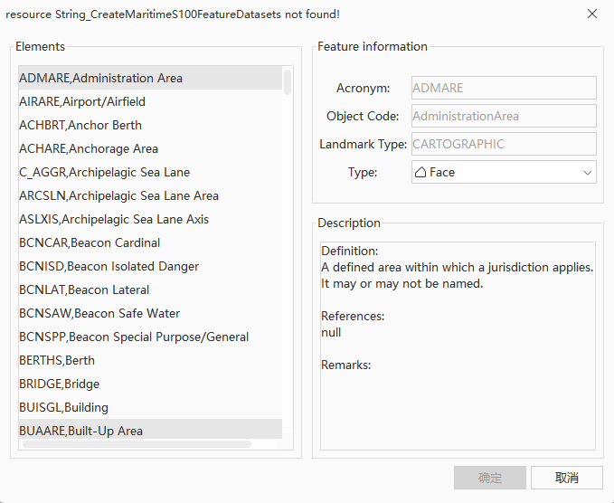
Figure: Create a Feature Dataset Dialog Box - Select Elements: In the list of elements, select the type of feature dataset to be created.
- After selecting the elements, view their details, including name, code, and type. Select the geometry type from the dropdown list on the right of Object Type. It supports creating points, lines, areas, and attribute tables (non-spatial objects).
- The object types that different features can create are determined by the feature configuration in the S-101 Feature Catalogue (FC). As shown in the figure below, the
Bridgefeature in the FC is configured with<S100FC:permittedPrimitives>values ofcurve,surface, andnoGeometry. Therefore, Bridge can create areas, lines, and non-spatial objects.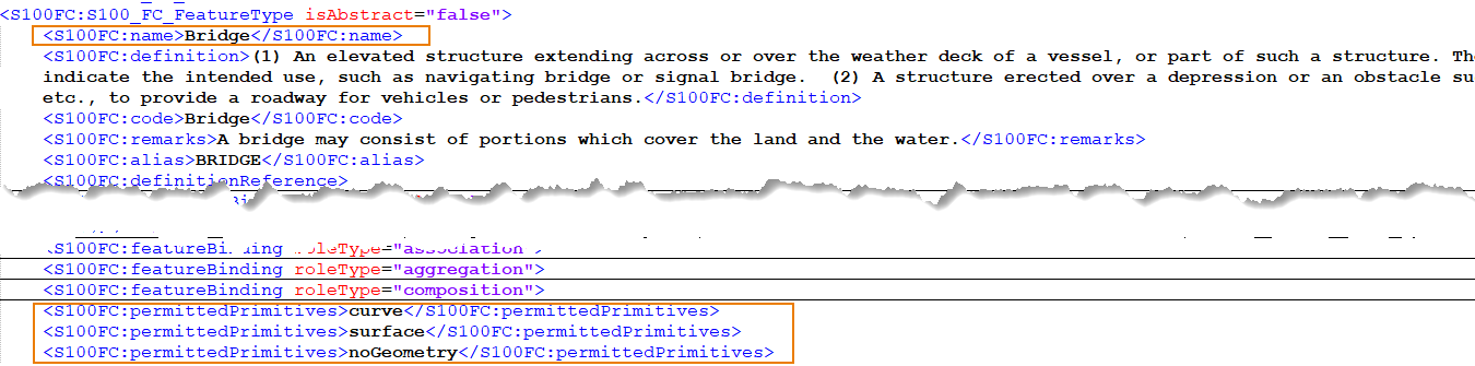
- In the description text box, you can view the definition, reference information, and remarks of the current feature.
Related Topics