


Feature Description
The feature display control helps users manage the visibility and selectability of features in nautical charts, simplifying map information and improving browsing and operational efficiency. For example, when combining land with nautical charts, users can hide irrelevant land features to achieve clearer layer display. By controlling feature selection states, unnecessary selections can be avoided, enhancing operational precision and efficiency.
- Visible: Controls feature visibility on the map.
- Selectable: Determines whether features can be selected for further operations.
Steps
- Load the required chart group into the map.
- Select the Chart Tab -> Nautical Chart Properties group -> Click the Nautical Chart Properties button to open the right-side properties panel.
- Click the Element Settings button in the Filter Settings area to open the dialog.
-
Toolbar buttons in the dialog:
-
Select All: Select all records in the list.
-
Select Reverse: Invert current selection.
-
Reset: Restore dialog settings to initial state (does not affect search results).
-
-
Object type configurations:
-
Visible: Controls feature visibility in the current map. Users can customize visibility to hide irrelevant features. By default, all features are visible.
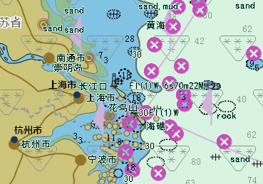
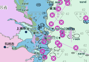
For example, when working with chart data, marine and adjacent land information are often displayed together. In practical use with topographic maps, land features can be hidden to achieve desired display effects.
As shown below, the left image displays unmasked land features that obscure topographic information, while the right image shows combined chart and topographic data after hiding land features.
-
Selectable: Controls whether features can be selected for operations. By default, all features are selectable.
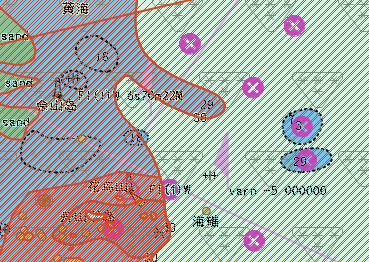
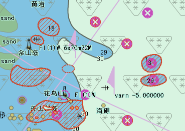
Since chart features are superimposed on a single layer, selecting objects may capture multiple elements simultaneously. Disabling selection for non-target features improves editing accuracy.
The illustration below shows default obstacle selection (left) versus selective obstacle selection configuration (right).
-
Object Type: Displays all feature types contained in the current map.
-
 Tip:
Tip: The selectable status depends on visibility - only visible features can be made selectable.
Related Topics
Loading and Displaying Nautical Charts