


Aspect Analysis
Instructions for use
Aspect Analysis is used to calculate the orientation of the slope surface of each pixel in the Raster Dataset (usually using DEM data). Aspect is calculated from 0 to 360 °, starting at 0 ° due north, moving clockwise, and ending 360 ° back to due north. Flat slopes have no direction and are assigned a value of -1. For the principle of Aspect Analysis and the Calculator Method, see the Slope and aspect section of About Surface Analysis.
Application Example
Open the Terrain "Datasource under the Exercise Data/Raster Analysis folder, and there is DGM data with a resolution of 5 meters, which we will use as an example.
Function entrance
- On the Spatial Analysis tab-> Raster Analysis-> Surface Analysis-> Aspect Analysis;
- Toolbox-> Raster Analysis Tools-> Surface Analysis-> Terrain Calculation-> Aspect Analysis. (iDesktopX)
Main parameters
- Source data
- Datasource: All the Datasources in the Current Workspace are listed. Select the Datasource where the Dataset for Aspect Analysis is located.
- Dataset: Lists all Raster Dataset (GRID) in the Current Data source. Select the Dataset to be used for Slope Analysis in the list. Generally, we will select the DEM data with elevation values. The Dataset selected in Workspace Manager is automatically located here.
- Result Data
- Datasource: All the Datasources in the Current Workspace are listed. Select the Datasource where the Result Dataset is located. Default is the same as Source Datasource.
- Dataset: Sets the name of the Result Dataset. The newly generated aspect Dataset is a Dataset of the same size and resolution as the Source Dataset.
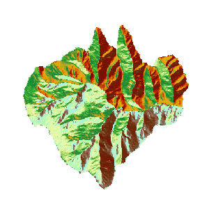 |
| Figure: Calculate Aspect Result. |
 Related topics