Instructions
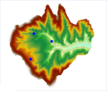
Extracts all the isolines with altitudes equal to the values at the mouse-clicked locations.
- The source dataset from which isolines are extracted must be a DEM or a Grid dataset.
Sample Application
Open the datasource Terrain in the folder ExerciseData/RasterAnalysis. The datasource includes DEM data with the resolution of 5 meter.
Functional Entrances
- Click the Spatial Analysis > Raster Analysis > Surface Analysis > Extract Isolines > Extract Isolines by Points.
- Toolbox > Raster Analysis > Surface Analysis > Extract Isolines > Extract Isolines by Points. (iDesktopX)
Main Parameters
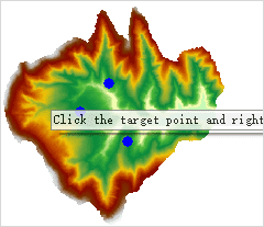
- Move your mouse on the map, and the mouse will become a cross, click on the map to select one or more points which need to extract the contours:
- After the selection is completed, right click the mouse to bring out the “Isolines by Point”.
- Set required parameters in the dialog box. For details on these parameters, please refer to Description of common parameters.
- Click OK to extract isolines.

