


Batch Dehaze Processing for Imagery
Feature Description
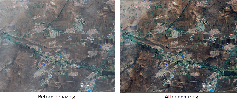
Affected by haze weather, remote sensing satellite images often exhibit color distortion and reduced contrast. Effective dehazing processing for remote sensing imagery can enhance contrast and restore image details.
This batch dehazing function automatically processes input image datasets to improve image quality.
Feature Entry
Toolbox->Imagery->Image Enhancement->Image Color Adjustment->Batch Dehaze Processing.
Parameter Description
| Parameter Name | Description | Type |
|
Input Image Dataset |
Add the image dataset that requires dehazing processing. | DatasetImage |
| Red Band Index | Original image band index corresponding to the red band of result image. Default value is 2. | Integer |
| Green Band Index | Original image band index corresponding to the green band of result image. Default value is 1. | Integer |
| Blue Band Index | Original image band index corresponding to the blue band of result image. Default value is 0. | Integer |
| Dehaze Coefficient | Indicates the degree of dehazing, ranging [0,1]. Default value is 0.85. | Double |
| Transmittance Lower Bound | Minimum transmittance value for calculation, ranging [0,1]. Default value is 0.3. | Double |
| Output Directory | Set the save path for processing results. | String |
| Output Image Settings | Configure result image parameters including file type and compression method. Typically used with Create Output Image Settings tool. Can be ignored when using this tool independently. |
Output
Dehazed image data.
Related Topics