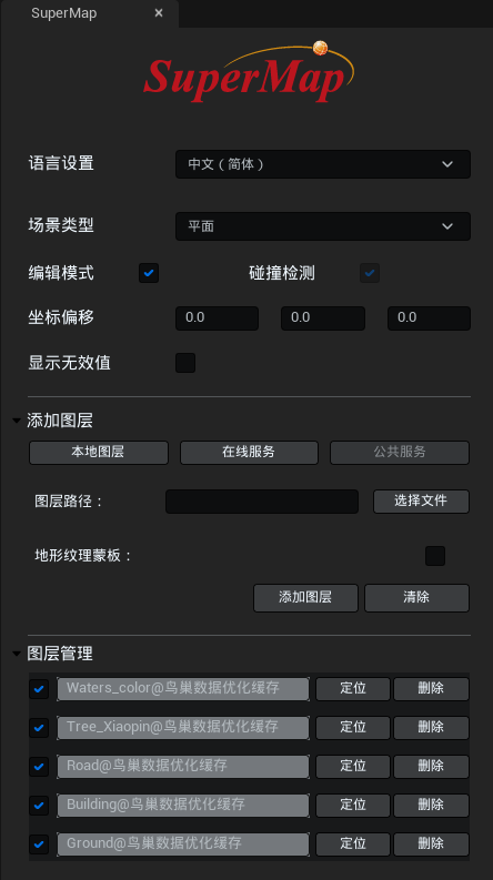
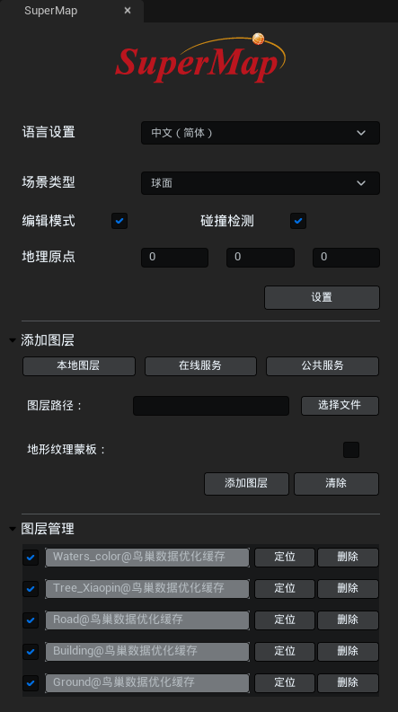
This page describes the main elements of the SuperMap editor control and their roles.
SuperMap editor controls are mainly used for setting before scene operation, mainly including scene type selection, adding local layer, adding iServer service layer, adding public service layer, deleting layer, insertion point position, geographical origin setting, etc.
The SuperMap Editor control opens in Content Browser>Plugins>SuperMap Content>BluePrints>SuperMapUI>SuperMap Editor Control. After locating and selecting the SuperMap editor control, right-click and select Run Editor Tool Control, the SuperMap editor control panel will pop up.
 |
 |
Language settings
This product is available in three language modes: Chinese, English and Japanese.
Scene type
This product offers two scene types: planar and spherical.
Different scenes support different coordinate systems. Spherical scenes support loading data in geographic and projected coordinate systems. Planar scenes support loading data in planar coordinate systems and projected coordinate systems.
Edit mode
When enabled, it supports displaying loaded GIS data in the Unreal Engine editor state.
Collision detection
When turned on, loaded GIS data can collide with collision-enabled objects in Unreal Engine. Flat scenes are on by default.
Coordinate offset
This feature is only available for flat scenes. Mainly used to set insertion point coordinate values to translate data near the origin of the Unreal Engine world coordinate system.
If the loaded data is model tile data, the position value in the data configuration file (*.scp) can be used as the insertion point coordinate value. If the terrain tile data is loaded, it is recommended to refer to the Bounds value in the data configuration file (*sct) and use the center point of the Bounds as the x,y coordinates of the insertion point.
Show invalid values
This feature is only available for flat scenes. It is mainly used to control whether to display invalid terrain values, not displayed by default. If only image data is loaded in the planar scene, it is recommended to check this value to ensure normal display of data.
Geographic origin
This function is only available for spherical scenes. You can only set the geographical origin after you turn on edit mode. The geographical origin is used to ensure that the sky, atmosphere, shadows and other effects of Unreal Engine are used normally in 3D geographical scenes.
It supports setting the specified latitude and longitude coordinate value as the geographical origin. The geographical coordinate value of the specified position can be obtained through SuperMap iDesltopX.
Add layer
This product offers three modes: Local Layer, Online Service, and Public Service. For more information, see Loading GIS Data with SuperMap Editor Controls.
Layer management
This module is mainly used to display and manage the layers added to the scene, including: display layer list, control layer display and hide, locate to layer, delete layer.


