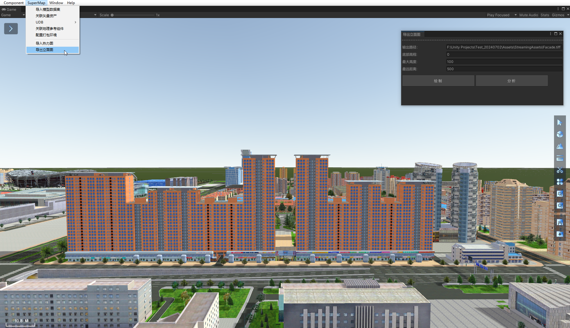
Elevation
Elevation can reflect the appearance and facade of buildings, and is often used as one of the bases for visually evaluating the aesthetics of buildings, and is often used in urban planning and management.
Elevation function of this product can generate elevation effect in real time according to architectural landscape in scene.
The specific operation steps are as follows:
- After loading the specified data in the currently running scene, click Scene -> Elevation to pop up the Elevation Settings panel.
- Before drawing the analysis area, set the parameters:
- Output Path: Sets the output path for the generated elevation. Click Select , select the specified path in the pop-up Choose folder dialog box, and click Select Folder to complete.
- Resolution: indicates the resolution of the output picture, with the value range of [0.0, 1.0], in meters/pixel, and the default value of 0.5. The resolution can be set by entering a value directly or by pulling the slider. The smaller the value, the higher the resolution.
- Maximum Distance: represents the maximum distance from the drawing line. This value determines the distance range of the drawing. The value range is [0.0, 2000.0]. The unit is meters. The default value is 500.0. The maximum distance can be set by entering a numerical value directly or by pulling the slider.
- Maximum height: represents the top elevation for elevation drawing. The value range is [0.0, 2000.0], the unit is meters, and the default value is 100.0. It represents the height range for drawing 100 meters upward from the bottom elevation. The maximum height can be set by entering a value directly or by pulling the slider.
- Bottom Elevation: indicates the bottom elevation from which elevation drawings are drawn. The value range is [0.0,500.0]. The unit is m. The default value is 0.0. It indicates that elevation drawings are drawn upward from ground level. You can set the bottom elevation by entering a value directly or by pulling the slider.
- When the parameters are set, click Draw and pick two points in the scene as analysis lines by clicking the left mouse button.
- Click Output to export elevations under specified paths according to set parameters.
- Click Clear to clear analysis effects from the scene.
 |
| Elevation interface |


