Function Description
This function is used to create single-valued thematic maps for visualizing categorical spatial data by assigning distinct colors to unique attribute values.
Supported Data Sources
- iPortal Data Resource
Supported Formats: STRUCTUREDDATA
- Uploaded Files (via AI Assistant interface)
Supported formats: CSV, Excel, GeoJSON, Shp (supported data format *.zip), maximum 200MB
1. GeoJSON data stored in JSONL format is not supported for upload;
2. Data must be uploaded via the SuperMap iPortal AI Assistant interface. Uploading directly through SuperMap iPortal may cause tool invocation failure.
Function Entrance
Two methods are available to generate single-valued thematic maps.
Directly Input Single-Valued Thematic Map Command in the Dialog Box
- Click Dialog on the left panel of the main interface.
Click Single-Valued Thematic Map Command in "Instruction Center"
- Navigate to Instruction -> Map Visualization Tools on the left panel.
Operation Steps
Directly Input Single-Valued Thematic Map Command in the Dialog Box
In the dialog box, enter a command such as: "Use the '京津土地利用面 ' dataset to assign distinct colors to different land types based on the 'LANDTYPE' field", then click the Execute button.
Click Single-Valued Thematic Map Command in "Instruction Center"
Within the "Map Visualization Tools" section, click the Single-Valued Thematic Map Drawing box. The preset command will populate the dialog automatically. Click Execute to proceed.
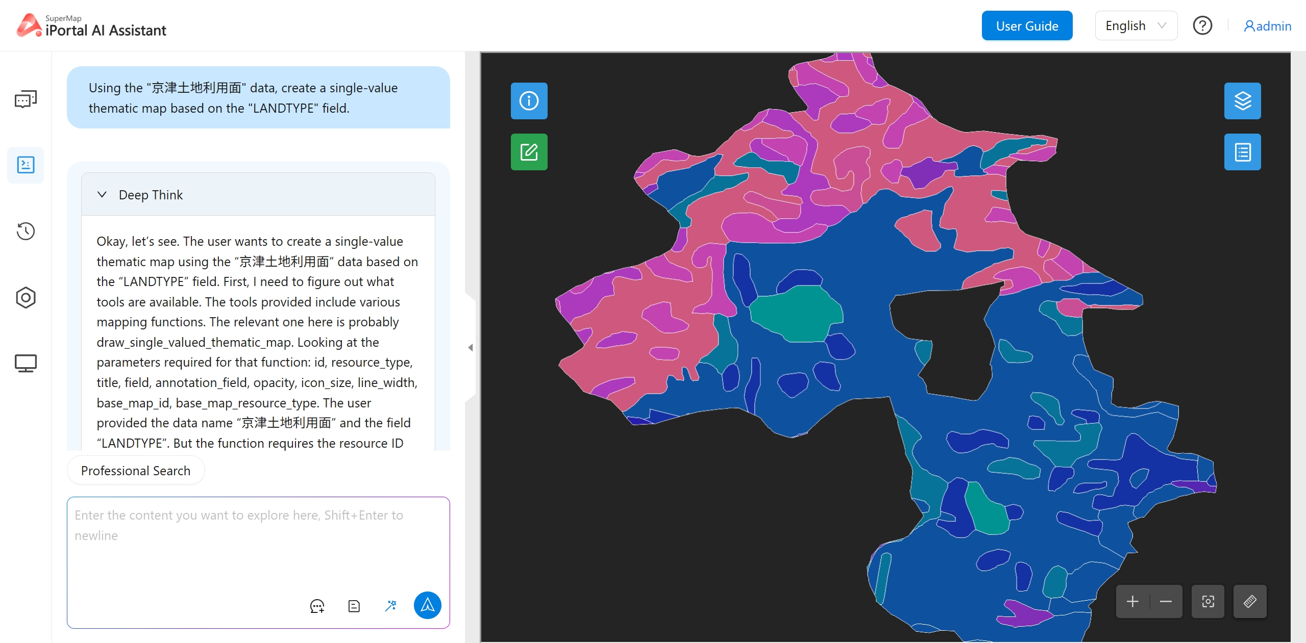 |
| Figure: Single-Valued Thematic Map Visualization |