Visibility Analysis
Function Description
This tool is used to perform visibility analysis on a specified scene resource ID based on the given latitude and longitude coordinates, considering distance, height, horizontal angle, and vertical angle.
Supported Data Sources
- iPortal Scene Resource
Function Entry
Two ways to perform visibility analysis.
Direct Command Input in Dialog Box
- Locate the Dialogue panel on the left side of the main interface.
Select Command via Instruction Center
- Navigate to Instruction-> 3D Analysis Tool on the left panel of the main interface.
Operation Steps
Direct Command Input in Dialog Box
Enter the visibility analysis command in the dialog box, then click the Execute button.
For example:"View the 'Beijing CBD' scene resource, and perform viewshed analysis with the coordinates of the China World Hotel in Beijing as the target point".
Select Command via Instruction Center
In the 3D Analysis Tool section, click the Visibility Analysis command box. The preset command content in the box will be automatically added to the dialog box, then click the Execute button.
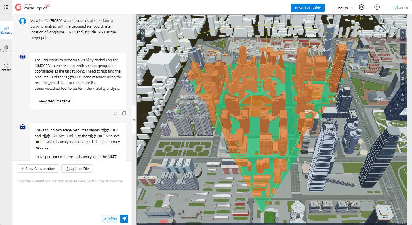 |
| Figure: Visibility Analysis |