URI
<spatialAnalyst_uri>/geometry[.<format>]
Supported methods
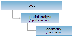
Parent resource
Child resources
geometryBufferResults, geometryOverlayResults, geometryIsolineResults, geometryIsoregionResults, geometryThiessenPolygonResults, routeCalculateMeasureResults, routeLocatorResults, geometryInterpolation, relativePosition3D, geometryMinDistanceResults
Introduction
The root resources for the spatial analysis on geometry.
Supported methods:
- GET: Returns child resources, that it, the list for the spatial analysis methods supported.
- HEAD: Checks the existence of the geometry resource, or whether the client has the permission to access the geometry resource.
Supported output formats: rjson, json, html, xml.
GIS Services Resource Hierarchy
HTTP request methods
Implement the HTTP request on the following URI, where supermapiserver is the server name, with rjson being the output format.
http://supermapiserver:8090/iserver/services/spatialanalyst-sample/restjsr/spatialanalyst/geometry.rjson
GET request
Returns child resources, that is, the list for the spatial analysis methods supported.
Response structure
Normal response code(s): 201. The response parameters are as follows:
| Field | Type | Description |
| name | string | The name of the spatial analysis function. |
| path | string | The access path for the spatial analysis function. |
Example usage
Implement the GET request on http://supermapiserver:8090/iserver/services/spatialanalyst-sample/restjsr/spatialanalyst/geometry.rjson and you will get the respons in rjson format, as shown below:
{
[{
"name": "buffer",
"path": "http://supermapiserver:8090/iserver/services/spatialanalyst-sample/restjsr/spatialanalyst/geometry/buffer",
"supportedMediaTypes": null,
"resourceType": null
},
{
"name": "overlay",
"path": "http://supermapiserver:8090/iserver/services/spatialanalyst-sample/restjsr/spatialanalyst/geometry/overlay",
"supportedMediaTypes": null,
"resourceType": null
}]
}
HEAD request
Asks for the response identical to the one that would correspond to a GET request, but without the response body. This is useful for retrieving meta-information written in response headers, without having to transport the entire content. The meta-information includes the media-type, content-encoding, transfer-encoding, content-length, etc.
The HEAD request helps check the existence of the geometry resource and whether it can be accessed by the client. By implementing the HEAD request on the URI, with .<format> appended to the end, we can quickly get to know whether the geometry resource supports the representation in <format> or not.
See
- spatialAnalyst, geometryBufferResults, geometryOverlayResults, geometryIsolineResults, geometryIsoregionResults, geometryThiessenPolygonResults, routeCalculateMeasureResults, routeLocatorResults, relativePosition3D, geometryMinDistanceResults
- Constructing REST Requests
- Status Codes
- SuperMap iServer REST API Output Formats
- GIS Services Resource Hierarchy