Coordinate query and attribute query can be realized through query operation.
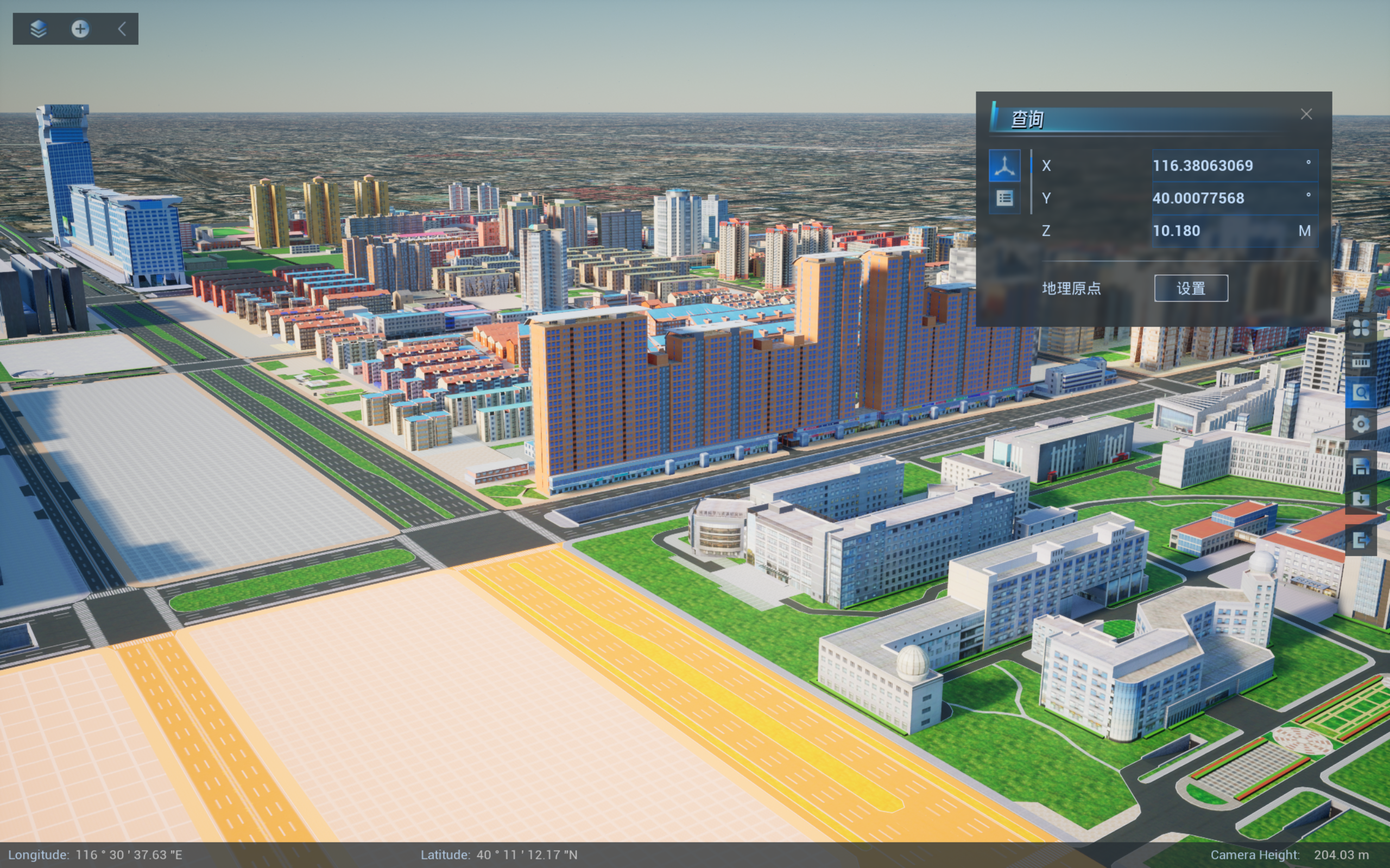
Coordinate query
The coordinate query function is used to query and display the latitude, longitude and elevation values of any position in the scene. Note that coordinates in spherical scenes are in degrees (longitude and latitude) and meters (elevation). The picked point can also be set as a geographic origin, and after the geographic origin is set, lighting, weather effects, etc. are used in this local area. The specific operation steps are as follows:
- Click on the query function panel and select the attribute query function;
- Click on the location you want to query in the scene, and its coordinate value will be displayed in the result bar;
- If you want to use lighting and weather in this place, you need to set the geographical origin.
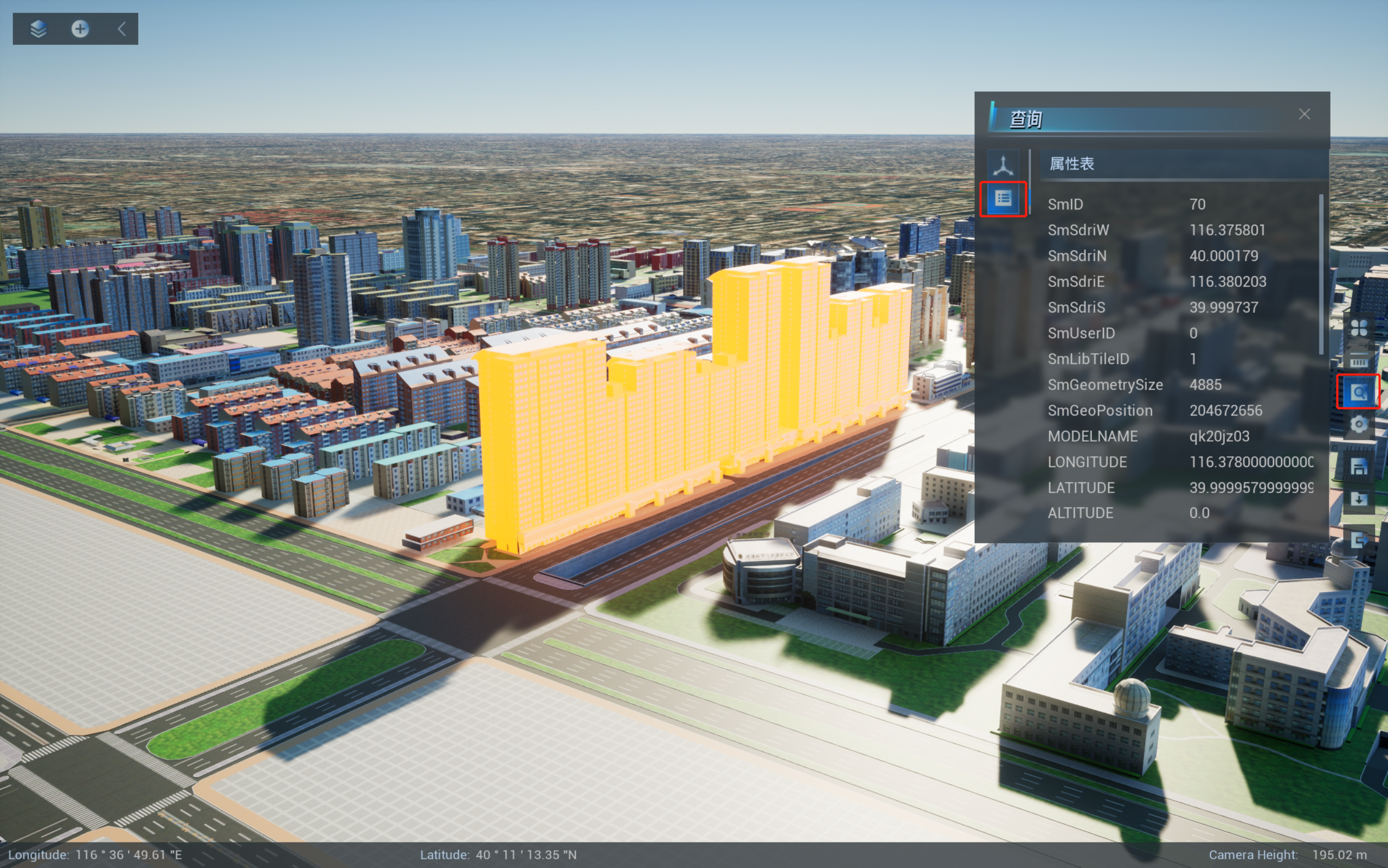
Attribute query
Attribute query function is used to query and display attributes of model objects in the scene. This function is only applicable to querying the attributes of data such as building white model, urban fine model and BIM. The specific operation steps are as follows:
- Click to open the query function panel and select the attribute query function.
- When you click the model, the attribute information of the current model will be displayed in the attribute box interface.