1. Background
Map Cartography is a professional discipline, which has high requirements for symbol and color configuration. After years of accumulation, it has formed its own symbol and color configuration system. This paper briefly introduces the background of Map Cartography from Map Type, map elements and map division. According to the color characteristics of different maps and the functions of symbols, colors and annotations of SuperMap, this paper puts forward a preliminary map symbol, color configuration scheme and map matching process.
1.1 Map Type
Maps are generally divided into ordinary maps and thematic maps, and statistical maps are divided from thematic maps according to different functions. Different Map Types are also different in color configuration scheme, map elements, map symbols and map outline decoration.
- A general map is a map that represents a variety of natural and socio-economic phenomena in a mapping area at a relatively balanced level of detail. Its content includes all map elements. This type of map is characterized by its emphasis on the delineation of regional outlines, land relief patterns, natural conditions and the results of human activities, and is also the geographical base map for the production of thematic maps. The colors are generally blue, black, brown and green. The water system is generally blue, the roads are generally black and brown, the vegetation is generally green, and the notes are generally black and blue. According to the scale, there are corresponding changes in the outline decoration.
- Thematic map is a map based on ordinary maps, which focuses on one or several natural or socio-economic phenomena in the mapping area. The remarkable feature of this kind of map is that the thematic elements as the subject of the map are expressed in detail, and the content of the geographical basis is different according to the subject, and some related elements are selectively expressed, so the content of the thematic map is composed of two parts: the geographical basis and the thematic elements. Thematic elements generally use the same color system, and consider the meaning of thematic elements to distinguish between cool and warm colors. The geographic base map is relatively simple.
- Statistical map generally uses the administrative region as the base map, and adopts the four-color mapping scheme. It is also equipped with pie, column and other statistical chart information. The color of the statistical chart shall be the color with larger contrast with the color of the base map. The outer boundary of the base map of the administrative region is generally colored.
1.2 Map elements
Common map elements are generally divided into 9 categories: residential area, vegetation, landform, boundary, road, water system, Measurement Control Point, independent feature, pipeline and fence. The first six items must be included. There are some small items under each category, plus notes. There are more elements. There are certain regulations on naming and grading.
Name of common map elements:
| Map features | English name | Chinese name | Explain |
| Measurement Control Point | Trigonometric point, stone-buried map root point, bench mark, astronomical point | ||
| Independent feature | An important object with a certain directional function or economic significance. For example, power plants, independent chimneys, water towers, etc. | ||
| Place of residence | respt | Settlement | Spotted settlement |
| respy | Place of residence | Area residential area of township, town and above | |
| Vegetation | landuse | Land Use | Forest, grassland, dry land, paddy field, etc. |
| Landform | terlk | Contour line | Counting curve, first curve, interval curve, etc. |
| ternt | Desert, snow cover, sideline, etc. | Other landforms such as desert, snow cover line, etc. | |
| Realm | bount | Realm | National boundaries, provincial boundaries, regional boundaries, county boundaries, township boundaries, village boundaries, etc. |
| boupt | Border markers | Dotted boundary markers | |
| province | Provincial boundaries | Provincial boundaries | |
| county | County boundary | County boundary | |
| Pipelines and barriers | |||
| Road | roalk | Road | Expressways, first-class highways, national highways, provincial highways, county and township roads, rural roads, small roads, highway bridges, etc. |
| railk | Railway | Railway | |
| Water system | hydnt | Water system line and surface | Major lakes, rivers, reservoirs, canals, etc. |
| hydlk | Water system point | Springs, wells, non-scale reservoirs, open reefs, submerged reefs | |
| Other elements | othnt | natural reserve | natural reserve |
| Auxiliary elements | atnlk | Names of peaks, islands, etc. | Names of peaks, islands, etc. |
| Geographic Grid | ggdln | Longitude and latitude lines, kilometer network | Longitude and latitude lines, kilometer network |
| Data quality | quapy | Topographic map compilation data | Data of topographic map compilation |
2. Symbol and color configuration scheme
In order to form a complete map, we need not only the corresponding map elements, but also the map symbol configuration, map color configuration, map thematic map configuration, map annotation configuration and map outline decoration. Map symbols are also divided into point symbols, line symbols and area symbols according to different map elements. There are different symbol styles and sizes for According to the scale.
2.1 1:250000, 1:500000 Topographic Map Symbol
Common dotted symbol configuration
| Name | ID | Size | Angle | Color |
| Cave | 250001 | 24 | Perpendicular to the sheet | RGB(0,0,0) |
| Power plant | 250002 | 45 | Perpendicular to the sheet | RGB(0,0,0) |
| Mine | 250003 | 48 | Perpendicular to the sheet | RGB(0,0,0) |
| Temple | 250004 | 24 | Perpendicular to the sheet | RGB(0,0,0) |
| Tower | 250005 | 24 | Perpendicular to the sheet | RGB(0,0,0) |
| Boundary markers | 250008 | 40 | Perpendicular to the sheet | RGB(0,0,0) |
| Elevation point | 250007 | 12 | Perpendicular to the sheet | RGB(0,0,0) |
| Settlement | 250010 | 40 | Perpendicular to the sheet | RGB(0,0,0) |
| A detached house | 250006 | 32 | Perpendicular to the sheet | RGB(0,0,0) |
| Lone peak | 250009 | 32 | Perpendicular to the sheet | RGB(173,113,0) |
Common Linear Symbol Configuration
| Name | ID | Width | Color |
| Major rivers | 0 | 2 | RGB(0,170,231) |
| Lake side line and coastline | 0 | 1 | RGB(0,170,231) |
| Counting Curve | 0 | 2 | RGB(173,113,0) |
| First Curve | 0 | 1 | RGB(173,113,0) |
| Scarp | 251001 | 1 | RGB(173,113,0) |
| Boundary line of residential land | 0 | 1 | RGB(173,0,0) |
| Single-track railway | 0 | 5 | RGB(0,0,0) |
| Double-track railway | 251002 | 5 | RGB(0,0,0) |
| The highway | 251003 | Outer 8, inner 4, fixed | Outer RGB (173,0,0), Inner RGB (255,125,123) |
| Grade Highway | 0 | 4 | RGB(173,0,0) |
| Off-grade highway | 0 | 2 | RGB(173,0,0) |
| The main road | 0 | 1 | RGB(0,0,0) |
| Path | 251004 | 1 | RGB(0,0,0) |
| National boundaries | 251005 | Fixed | RGB(0,0,0) |
| Provincial boundaries | 251006 | 3 | RGB(0,0,0) |
| Regional boundaries | 251007 | 3 | RGB(0,0,0) |
| County boundary | 251008 | 2 | RGB(0,0,0) |
| Special area boundary | 251009 | 2 | RGB(0,0,0) |
| The Great Wall | 251010 | 1 | RGB(0,0,0) |
| Land Use boundary | 5 | 1 | None |
Configuration of Common Area Symbols
| Name | ID> | Foreground color | Background color |
| Rivers, lakes and reservoirs | 0 | Deep RGB (115,223,255), Light RGB (189,235,255) |
Deep RGB (115,223,255), Light RGB (189,235,255) |
| Place of residence | 0 | RGB(255,125,123) | RGB(255,125,123) |
| Sand | 14 | RGB(173,113,0) | RGB(255,255,255) |
| Saline-alkali land | 94 | RGB(173,113,0) | RGB(255,255,255) |
| Forest | 0 | RGB(214,255,189) | RGB(214,255,189) |
| Economic Forest | 73 | RGB(82,255,0) | RGB(214,255,189) |
| Grassland | 84 | RGB(82,255,0) | RGB(255,255,255) |
| Shrubbery | 79 | RGB(82,255,0) | RGB(214,255,189) |
Common Annotation Symbol Configuration
| Name | Sample | Size | Font | Angle | Color |
| Capital | Beijing | H66 W0 | Black Body | 0 | RGB(0,0,0) |
| The residence of the people's government of a province, autonomous region or municipality directly under the Central Government | Xi'an | H54 W0 | Black Body | 0 | RGB(0,0,0) |
| Residence of the people's government of the autonomous prefecture | Yan'an City | Height 45 Width 0 | Boldface underline | 0 | RGB(0,0,0) |
| Prefecture-level municipal people's government residence | Zibo City | Height 45 Width 0 | Blackbody | 0 | RGB(0,0,0) |
| Residence of the people's government at the county level | Wuchang County | Height 35 Width 0 | Black Body | 0 | RGB(0,0,0) |
| Residence of town-level people's government | Yangping town | Height 28 Width 0 | Black Body | 0 | RGB(0,0,0) |
| An important village | Zhangjiacun | Height 28 Width 0 | Song typeface | 0 | RGB(0,0,0) |
| Explanatory note | Xi'an station | Height 20 Width 0 | Black Body | 0 | RGB(0,0,0) |
| The seven seas | The Pacific | Height 90 Width 0 | @ Song typeface italic | 290 | RGB(0,170,231) |
| Oceans | East China Sea | H72 W0 | @ Song Ti | 290 | RGB(0,170,231) |
| River | The Yangtze River | H54 W0 | @ boldface | 290 | RGB(0,170,231) |
| Lake | Taihu Lake | H48 W0 | @ Song Ti | 290 | RGB(0,170,231) |
| Reservoir | Miyun Reservoir | Height 35 Width 0 | @ Song Ti | 290 | RGB(0,170,231) |
| Straits | Taiwan Strait | H48 W0 | @ Song Ti | 290 | RGB(0,170,231) |
| Archipelago | Xisha Islands | Height 54 Width 36 | Blackbody | 0 | RGB(0,0,0) |
| Islands | Hainan Island | H66 W44 | Song typeface | 0 | RGB(0,0,0) |
| Mountain range | Kunlun Mountains | H66 W0 | Black Body | 20 | RGB(0,0,0) |
| Mountain peak | General Mountain | Height 35 Width 0 | Blackbody | 0 | RGB(0,0,0) |
| Elevation point | 1370 | Height 16 Width 0 | Black Body | 0 | RGB(0,0,0) |
| Foreign capitals | Pyongyang | H54 W0 | Black Body | 0 | RGB(0,0,0) |
| Foreign first-level administrative center | Mandalay | Height 45 Width 0 | Blackbody | 0 | RGB(0,0,0) |
| General foreign cities | Behar | Height 35 Width 0 | Black Body | 0 | RGB(0,0,0) |
2.2 1:25000, 1:50000, 1:100000 topographic map symbols
Common dotted symbol configuration
| Name | ID | Size | Angle | Color |
| Trigonometric point | 250011 | 32 | Perpendicular to the sheet | RGB(0,0,0) |
| Root point of buried stone map | 250013 | 32 | Perpendicular to the sheet | RGB(0,0,0) |
| Bench mark | 250015 | 32 | Perpendicular to the sheet | RGB(0,0,0) |
| Astronomical point | 250016 | 32 | Perpendicular to the sheet | RGB(0,0,0) |
| Ordinary house | 250006 | 24 | Perpendicular to the sheet | RGB(0,0,0) |
| Cave dwelling | 250017 | 24 | Perpendicular to the sheet | RGB(0,0,0) |
| Power plant | 250019 | 40 | Perpendicular to the sheet | RGB(0,0,0) |
| Transformer room | 250018 | 24 | Perpendicular to the sheet | RGB(0,0,0) |
| Mine | 250003 | 48 | Perpendicular to the sheet | RGB(0,0,0) |
| Chimney | 250020 | 32 | Perpendicular to the sheet | RGB(0,0,0) |
| Water tower | 250021 | 24 | Perpendicular to the sheet | RGB(0,0,0) |
| Temple | 250004 | 24 | Perpendicular to the sheet | RGB(0,0,0) |
| Tower | 250005 | 32 | Perpendicular to the sheet | RGB(0,0,0) |
| Boundary markers | 250008 | 40 | Perpendicular to the sheet | RGB(0,0,0) |
| Elevation point | 250007 | 12 | Perpendicular to the sheet | RGB(0,0,0) |
| Lone peak | 250009 | 32 | Perpendicular to the sheet | RGB(173,113,0) |
Common Linear Symbol Configuration
| Name | ID | Width | Color |
| Major rivers | 0 | 2 | RGB(0,170,231) |
| Lake side line and coastline | 0 | 1 | RGB(0,170,231) |
| Counting Curve | 0 | 2 | RGB(173,113,0) |
| First Curve | 0 | 1 | RGB(173,113,0) |
| Scarp | 251001 | 1 | RGB(0,0,0) |
| Boundary line of residential land | 0 | 1 | RGB(0,0,0) |
| Single-track railway | 251011 | Fixed | RGB(0,0,0) |
| Double-track railway | 251012 | Fixed | RGB(0,0,0) |
| The highway | 251013 | Fixed | Fixed |
| Grade Highway | 251014 | Fixed | Fixed |
| Off-grade highway | 251015 | Fixed | Fixed |
| Country Road | 251016 | 1 | RGB(0,0,0) |
| Path | 251017 | 1 | RGB(0,0,0) |
| National boundaries | 251005 | Fixed | RGB(0,0,0) |
| Provincial boundaries | 251006 | 3 | RGB(0,0,0) |
| Regional boundaries | 251007 | 3 | RGB(0,0,0) |
| County boundary | 251008 | 2 | RGB(0,0,0) |
| Special area boundary | 251009 | 2 | RGB(0,0,0) |
| The Great Wall | 251018 | 1 | RGB(0,0,0) |
| Land Use boundary | 5 | 1 | None |
Configuration of Common Area Symbols
| Name | ID | Foreground color | Background color |
| Rivers, lakes and reservoirs | 0 | Deep RGB (115,223,255), Light RGB (189,235,255) |
Deep RGB (115,223,255), Light RGB (189,235,255) |
| Place of residence | 0 | RGB(0,0,0) | RGB(255,255,255) |
| Sand | 14 | RGB(173,113,0) | RGB(255,255,255) |
| Saline-alkali land | 94 | RGB(173,113,0) | RGB(255,255,255) |
| Forest | 0 | RGB(214,255,189) | RGB(214,255,189) |
| Economic Forest | 73 | RGB(82,255,0) | RGB(214,255,189) |
| Grassland | 84 | RGB(82,255,0) | RGB(255,255,255) |
| Shrubbery | 79 | RGB(82,255,0) | RGB(214,255,189) |
| Rice field | 68 | RGB(0,0,0) | RGB(255,255,255) |
| Dry land | 71 | RGB(0,0,0) | RGB(255,255,255) |
Common Annotation Symbol Configuration
| Name | Sample | Size | Font | Angle | Color |
| Capital | Beijing | H66 W0 | Black Body | 0 | RGB(0,0,0) |
| The residence of the people's government of a province, autonomous region or municipality directly under the Central Government | Xi'an | H54 W0 | Black Body | 0 | RGB(0,0,0) |
| Residence of the people's government of the autonomous prefecture | Yan'an City | Height 45 Width 0 | Boldface underline | 0 | RGB(0,0,0) |
| Prefecture-level municipal people's government residence | Zibo City | Height 45 Width 0 | Blackbody | 0 | RGB(0,0,0) |
| Residence of the people's government at the county level | Wuchang County | Height 40 Width 0 | Blackbody | 0 | RGB(0,0,0) |
| Residence of town-level people's government | Yangping town | Height 35 Width 0 | Blackbody | 0 | RGB(0,0,0) |
| An important village | Zhangjiacun | Height 30 Width 0 | Song typeface | 0 | RGB(0,0,0) |
| Explanatory note | Xi'an station | Height 25 Width 0 | Black Body | 0 | RGB(0,0,0) |
| Oceans | East China Sea | Height 90 Width 0 | @ Song Ti | 290 | RGB(0,170,231) |
| River | The Yangtze River | H72 W0 | @ Song Ti | 290 | RGB(0,170,231) |
| Lake | Taihu Lake | H66 W0 | @ Song Ti | 290 | RGB(0,170,231) |
| Reservoir | Miyun Reservoir | H48 W0 | @ Song Ti | 290 | RGB(0,170,231) |
| Archipelago | Xisha Islands | H66 W44 | Black Body | 0 | RGB(0,0,0) |
| Islands | Shengsi Islands | Height 54 Width 36 | Black Body | 0 | RGB(0,0,0) |
| Mountain range | Kunlun Mountains | H66 W0 | Black Body | 20 | RGB(0,0,0) |
| Mountain peak | General Mountain | Height 35 Width 0 | Black Body | 0 | RGB(0,0,0) |
| Elevation point | 1370 | Height 16 Width 0 | Black Body | 0 | RGB(0,0,0) |
3. Precautions for drawing
There are strict rules for each map element and the order of compilation in ordinary Map Cartography. For example, the distribution characteristics and density difference of residential areas, the grade, traffic condition, distribution characteristics and density difference of roads, the structural characteristics and density of river network, the line difference of Measurement Control Point, etc. In addition, it is necessary to consider the disconnection treatment and rationality check when the elements are overlapped. However, in the process of computer graphics representation, the unnecessary data is usually filtered out in the Data Processing stage, so there is no need to consider the problem of symbol density, and because the problem of gland disconnection will affect the continuity of data, the problem of gland disconnection is generally not considered in computer graphics. As a result, there are some differences between the compilation order of ordinary maps and the map layer order and mapping process represented by computers.
In computer cartography, it is necessary to add data to the map and organize the overlay relationship of map layers according to the map elements. Then with a variety of symbols, thematic maps and statistical maps should also be accompanied by the corresponding theme and Statistic Infomation. The configuration of a complete map can be completed by adding annotation information, and finally adding map frame, title annotation and other map outline decoration information.
3.1 Layer organization
If you want the map to be beautiful, first of all, you need a reasonable way of layer organization. We can organize the map elements according to the nine elements of the ordinary map. The sequence of layers from bottom to top shall be: vegetation (Land Use), water system surface, landform (contour line, etc.), water system line, road, boundary, residential area, pipeline and fence, Measurement Control Point, independent features, and annotation. Under each layer, map elements can also be divided into different levels according to Attributes. On this basis, thematic maps and statistical maps also need some thematic and Statistic Infomation. Finally, the outline of the map is decorated.
3.2 Style configuration
Before configuring the style of each layer, you need to set the map Scale Settings to the same scale as the selected frame.
In addition to the symbol and color scheme mentioned above, the Marker Style configuration of the map also needs to consider some other color schemes. For example, the four-color map of the administrative region, the color of the administrative boundary and so on.
The color matching of administrative regions generally adopts colors with large hue difference and high brightness. Such as light yellow (255, 255, 223), light green (223, 255, 223), light blue (223, 223, 255), light pink (255, 223, 255).
Administrative borders are generally colored in pink (dark (255,0,198), light (255,133,222)) and brownish-red (dark (255,0,0), light (255,255,123)). And because of the problem of computer processing, the effect of using linetype offset is not very good. We usually use the linetype with the same width on both sides or buffer filling as the lining color. Then the administrative area surface covers the part of the line type in the administrative area to achieve the purpose of boundary lining.
3.3 Note adjustment
After the digitization of Map Cartography, the annotations are usually stored in the attributes of point, area and line map elements, and the attributes need to be represented on the map as annotations through Thematic Label Map. However, the effect of Auto Label is often not the most ideal, which requires adjustment of part of the label, so before plotting, the Thematic Label Map will be converted into Text through the function of converting layer thematic map into CAD Dataset, and then adjust the position of Text, and then output the map.
3.4 Drawing outline finishing
Map outline decoration is the last process of mapping, and the outline decoration of ordinary maps, thematic maps and statistical maps is different.
The outline decoration of ordinary maps can be generated by our Standard Map Frame. With the legend, the legend is generally placed on the right side of the map. The automatically generated legend can not meet the requirements. It is necessary to break up the legend, then delete the redundant Layer Info, retain the thematic map and Symbol Information, and then adjust the order of symbols and text descriptions. Put the text on the left and the symbols on the right. The font of the text is Song typeface, 12 in height, 0 in width and black. In addition, because the ordinary map is generated according to the standard map sheet, the map is marked with information such as longitude, latitude and magnetic declination, and the north direction is also radial, not just one direction, so the compass must not be added.
The outline decoration of thematic maps generally requires information such as map title, legend, map frame, scale, compass, Publisher, possession annotation, etc. The legend of the thematic map is relatively simple, as long as the legend of the thematic information is displayed. However, the title must accurately describe the feature information of the theme. The frame is also relatively fancy and needs some texture. This can be done by laying out the Complex of the map. Some thematic maps can also put two maps with the same geographic information but different thematic information together to form a layout at the same time. For example, the rainfall in January and the rainfall in July.
The outline of a statistical map is similar to that of a thematic map. Only the legend is expressed in the form of a statistical chart, and the frame does not need to be too complicated, and generally there will be tables and other ancillary information.
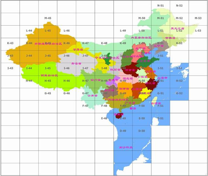
Comparison map of millions of maps and provincial administrative boundaries in China: